Monday August 20, 2018 – approx. 207 km today – approx. 2.759 km total
Coming soon …
Monday August 20, 2018 – approx. 207 km today – approx. 2.759 km total
Coming soon …
Sunday August 19, 2018 – approx. 65 km today – approx. 2.552 km total
Coming soon … stay tuned, it’s going to be incredible!
Sunday August 18, 2018 – approx. 47 km today – approx. 2.487 km total
Today, I just spent almost the entire day on the Peace Arch RV campground doing my laundry and some office work. I checked my mails, did my accounting, and updated my travel plans. Nothing special to report about.
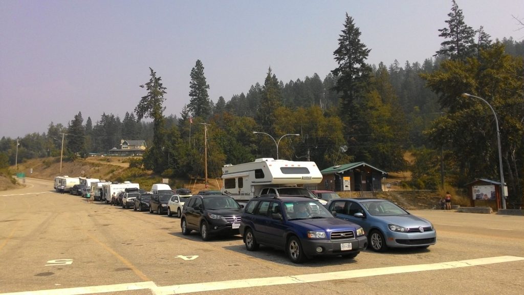
The night I spend on the Tsawwassen Walmart parking lot – by the way together with a lot of other RVs and campers – since I had to be at the ferry terminal early in the morning to sail over to Vancouver Island.
Friday August 17, 2018 – approx. 56 km today – approx. 2.440 km total
Coming soon …
Thursday August 16, 2018 – approx. 48 km today – approx. 2.384 km total
Today, I spent the entire day in Vancouver city. After breakfast, I drove to the closes station of the Vancouver Sky Train and parked my car there. Unfortunately, the information from the website was only half true, so I had to pay 14 dollars instead of the calculated 10 for parking. However, I bought myself a day ticket for the Sky Train which would also allow me to use the Sea Bus which I did not have a clear idea what it was at that point in time.
From the King George station to Vancouver downtown, it took me about 45 minutes. There, I looked for the visitors center to get some ideas of what to do in the city. Unfortunately, the advices of the employee there were good, but not exactly what I had expected. However, I managed to get a better idea of what I could and should do during the next days in Vancouver. After the visitors center, I strolled a bit around Canada Place and headed then to the Vancouver Lookout tower. From up there, you have beautiful view to downtown and the surroundings. I spent quite a time up there also planning my walking tour through the city from the birds eye perspective.
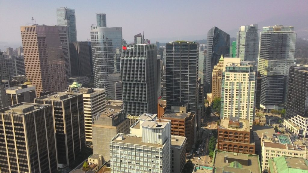
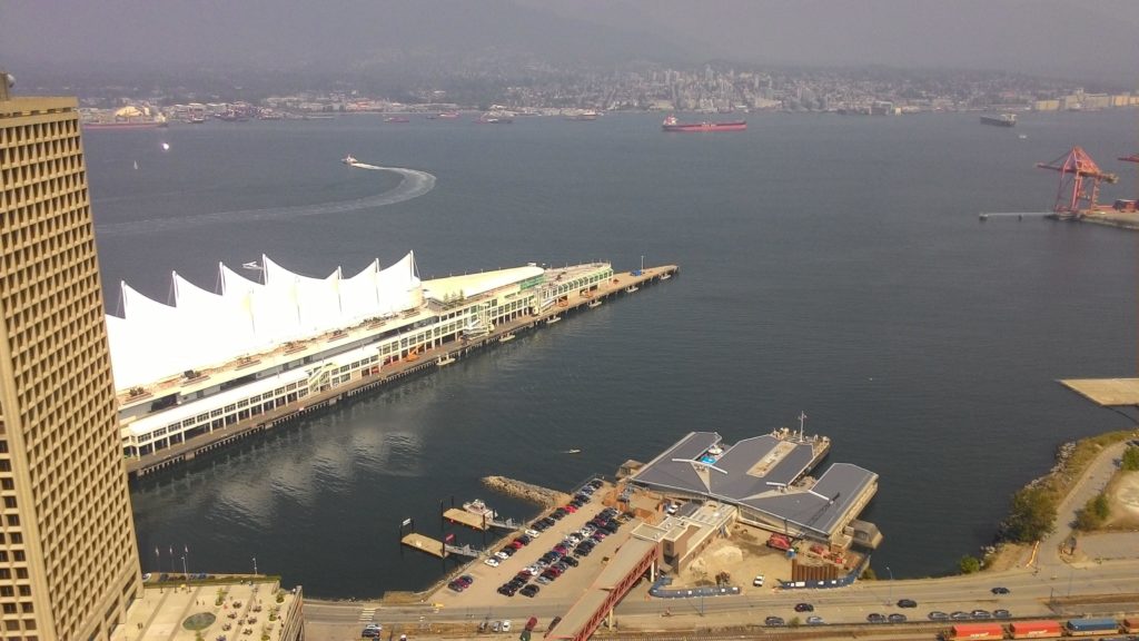
Back to the ground, I walked along the Waterfront from Canada Place all the way to the aerodrome and watched the sea planes coming and going. This is really a cool thing and I decided to bring my big lens tomorrow to take some closer pictures of that landing and take-off spectacle. I also dropped by a few bike rental companies as this was my idea for tomorrow. From what I have seen up to that point in time, I was impressed: Vancouver is really a beautiful city!
With one of the electric busses, I made my way back to the part of the city called Gastown. On the Vancouver Lookout I have read that there are supposed to be a lot of cafes and sandwich shops and in the meantime I felt a bit hungry. Unfortunately, I did not find anything appealing, so finally, I returned to Canada Place and got myself a sandwich there.
After lunch, I went over to North Vancouver with the Sea Bus which is essentially a large ferry boat shuttling back and forth from Waterfront station to Loneby peer. My idea was to have a great view onto the skyline of the city, but unfortunately the sun was directly shining against my view and with all the smoke in the air, the view was quite limited. I decided to come back here tomorrow evening to take pictures of the skyline at dawn.
In the later afternoon, I strolled a bit through Chinatown which in fact was not really that appealing. In contrary, I accidentially even turned into a street which seemed to be the ghetto of homeless and drug junkies of the city. The next day, I actually found this blog post when searching for information about the city of Vancouver. The mentioned Hastings Street East is exactly the one I accidentially turned into.
From Chinatown, I made my way back to the Vancouver Lookout about an hour before sunset as I wanted to be up there for sunset and the time after seeing all the lights in the city to come up. Luckily the ticket was valid for the entire day, so I was able to go up there once again.
I spent about one hour and a half on the Vancouver Lookout, watched the sunset and finally the lights of the city. At around 9:30 pm, I went down and took the Sky Train back to the King George station since my parking ticket seemed to be valid only until 22:30 pm. I quickly returned to the campground since I was unsure until which time, I could enter it, but there was no gate closed whatsoever. So I decided to drive to a Boston Pizza restaurant to have dinner there. The pizza there was good but also nothing that spectacular.
Shortly after 11 pm I returned to the campground where the gate was now closed. But the guard on duty did not even ask me anyhing and just let me in. I directly went to my tent and fell asleep quickly.
Wednesday August 15, 2018 – approx. 252 km today – approx. 2.336 km total
Since, I saved some time by driving some hours more towards Vancouver yesterday, I got the idea to do some little hiking today after all the driving in the past days and before actually entering the city. The drive into Vancouver would take me about 2,5 hours today, so there was plenty of time to realize that idea. I checked the places along my today’s way and found the Sasquatch Provincial Park which offered a short 4 km walk around the Hicks Lake. I defined that as my intermediate stop today before I would finally enter Vancouver.
I followed the Trans-Canadian-Highway and eventually turned right into the road to Harrison Hotsprings and went on from there towards the Hicks Lake. From there I continued a couple of kilometers along the lake and was finally stopped by a sign stating that the road and the Provincial Park were closed due to the wildfire hazards. What a shame – once again, the wildfires changed my plans!
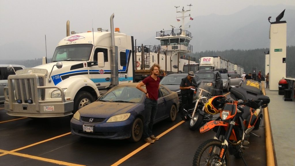
Since the decision was made now to leave the Rocky Mountains for the end of my roadtrip, I already figured the day before it might be reasonable to check the vacancies on the Inside Passage ferry from Port Hardy on the northern tip of Vancouver Island to Prince Rupert. And I was well-adviced with that idea: When I was just arriving at the closed entrance to the Sasquatch Provincial Park, I received a response to my yesterday’s booking request saying that I’m on a wait list already. So I called BC Ferries and managed to get an assured booking for August 26. That was actually even four days later than intended, but better than being on a wait list and maybe not being able to board once arriving up there in Port Hardy.
After clarifying all that, I tried to figure what to do next. I still wanted to enjoy a little bit the nature before entering the city of Vancouver. Checking my maps, I found the Kilby Park day use area on the Harrison River and set that as my next destination.
Arriving at the day use area, I enjoyed lunch and studies a bit the maps and guidebooks to adapt my travel plan to the new circumstances of a changed route and the four days delay on boarding the Inside Passage ferry. The updated idea was now to spend two days in Vancouver and maybe do a short stopover in Seattle, too. Then, I would continue to Vancouver Island, enjoy some days there driving along the island to its northern tip and take the Inside Passage ferry from there on August 26. From Prince Rupert, I would drive all the way up to Whitehorse, make the loop on the Top of the World Highway via Dawson and Beaver Creek with a short side jump to Alaska, USA and would then drive all the way back to Jasper in the Rocky Mountains. I was hoping that in September the wildfire situation had calmed down so that I could enjoy a couple of days in the Rocky Mountains at the end of my roadtrip. After that I would then return in a one-shot to Vancouver where I had to return my vehicle and fly back to Toronto.
After shuffling days back and forth and updating my plans until they made sense to me again, I felt better. I then decided it was time now for Vancouver. So I continued the final about 2 hours to the city and the Peace Arch RV campground which I had called and made a reservation with earlier that day already.
Arriving at the campground, I even managed to get a real site on the tenting area instead of the parking lot on the overflow parking just in front of the office building. However, staying on the tenting area meant that I had to set up my tent, as they did not allow me to stay in the car there – for whatever reason. So I set up my tent and arranged my belongings between the tent and the car and parked the car on the designated parking lot. After all that, I did not really feel like entering Vancouver that day and saved that for the next day. Instead, I used the time to do my laundry and use the internet while waiting. With that, it somehow became even too late for preparing a dinner, so I just returned to my tent and fell asleep soon.
Tuesday August 14, 2018 – approx. 645 km today – approx. 2084 total
After getting up this morning, I was glad having a shower available at the Karibu Park Cottages campground. Ather that shower, I proceeded as always with my selfmade breakfast: Oatmeal with fruits, coffee and orange juice. Also the cleaning up after any self prepared meal already follows the same procedures.
Once I got ready, I left the campground and turned onto the highway 6 again to follow it along the Slocan river and the subsequent Slocan lake all the way to New Denver. There, I turned right into the Selkirk Mountains towards Kaslo. On the way, I was even able to refill my water supplies in a wild stream rushing down the mountains. This already became one of my common procedures: I recycle old water bottles of bought drinking water by filling them with fresh water wherever possible and use it for cooking and cleaning dishes when staying in remote locations.
Arriving at Kaslo, I strolled a bit through the little town and enjoyed an ice cream.
Then, I bought myself a salad for lunch and headed further north – now again along the Kootenay Lake. Somewhere at the tip of the lake, I found a place to stop and have lunch. Actually that was really necessary as I felt hungry by that time.
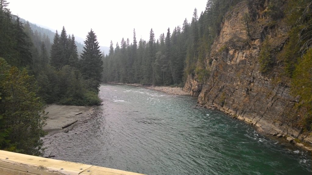
After lunch, I continued on my way towards the Trout Lake and finally the city of Revelstoke. The highway 31 turned into a gravel road shortly after the northern tip of Kootenay Lake, but from the Smith Dorian Trail in the Kanaskis area, I was already used to drive that type of roads. However at the southern tip of the Trout Lake, I found some boards explaining that this region is a real bear country since at certain seasons of the year there are trouts and salmons in the stream feeding the Trout Lake. Unfortunately, I was not lucky enough to spot one of them.
However, the way from the southern tip of the Trout Lake to Galena Bay was real fun to drive: The gravel road kept going up and down and it felt like a ralley already. I really enjoyed that part of the trip – hehe ;-).
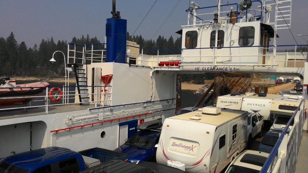
In Galena Bay, I boarded another ferry which took me to Shelter Bay where I somewhat returned to civilization after the remote area of the Trout Lake.
After disembarking the ferry, I checked the time and my travel plans. To that point, my idea was still to stop in or close to Revelstoke and on the next day return into the Rocky Mountains to try my luck again with the smoke of the wildfires. Now, that I actually almost arrived in Revelstoke, still had some time left this day and figured that the smoke situation had not significantly improved, the idea grew in my mind to continue towards Vancouver and leave the Rocky Mountains for the very end of my Canada 2018 roadtrip.
Before fixing that idea, I decided to first continue the final part up to Revelstoke and take the final decision there. The drive was not at all special and after about half an hour I arrived in Revelstoke. Stopping at a gas station, I once again checked my schedule and finally decided to follow that new plan. Since I still had a couple of hours left of this day, I even decided to drive on towards Vancouver and look for a place to stay the night on the way.
So I continued on the Trans-Canadian-Highway which actually did not feel that much of a trans-something-highway for the first tens of kilometers. It was more a mountaineous road going up and down along a deep valley. Since back in Revelstoke I decided to not fill up the car, I was in real need of a gas station soon and had to stop at the next one showing up along the way. With the car refilled and ready to hit the road again, I continued until around 10 pm when I finally became too tired. I managed to find a Wendy’s to have something to eat and chose a nearby rest area in MapsMe where I planned to spend the night.
However, somehow I missed the exit or MapsMe was wrong, so I even had to continue about 60 km more until I finally reached the Britton Creek rest area where I parked my car and fell asleep quite quickly.
Monday August 13, 2018 – approx. 160 km today – approx. 1439 km total
Oh yes, I know, I’m quite behind with my blog. But I’m trying to catch up now…
I slept quite well the first time camping in the wilderness. The next morning, I prepared myself the usual breakfast – oakmeal with banana and dried fruits – and afterwards made my way back to the highway 3A which winds its way up north along the Kootenay lake.
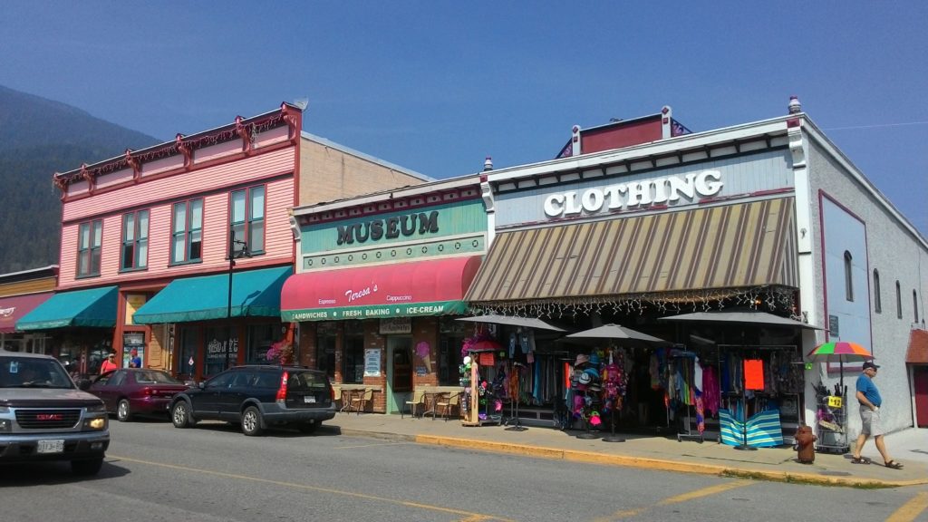
On the way, I stopped a couple of times to take pictures. Unfortunately, the vision was also limited here due to the smoke of the wildfires. However, I still enjoyed the drive along the lake and finally made it to Crawford Bay, a small accumulation of houses and shops of local handicraft. One of them was quite interesting:
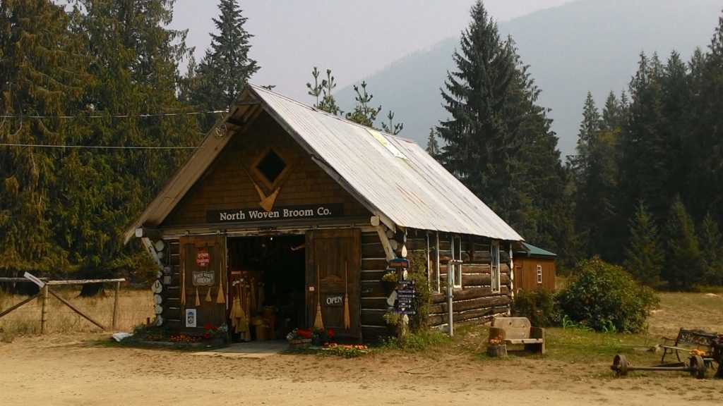
Believe it or not, but here, in the middle of the Canadian nowhere, most of the brooms for the quidditch games in the movie Harry Potter have been made. In the shop they explained how they are making those brooms up to now and there were also some interesting details given about their contract work for the set of Harry Potter.
After that short stop in Crawford Bay, it was just a couple of minutes more to drive up to Kootenay Bay where I boarded to ferry to Balfour. The crossing took 35 minutes and according to one of my guidebooks it is the longest free ferry ride in North America!
Arriving in Balfour, I first stopped at a local supermarket to get myself a salad for lunch. Then I headed further on the highway 31 along the north coast of the westarm of the Kootenay lake towards the town of Nelson. In between, I stopped for lunch which I enjoyed in a quite pleasant area:
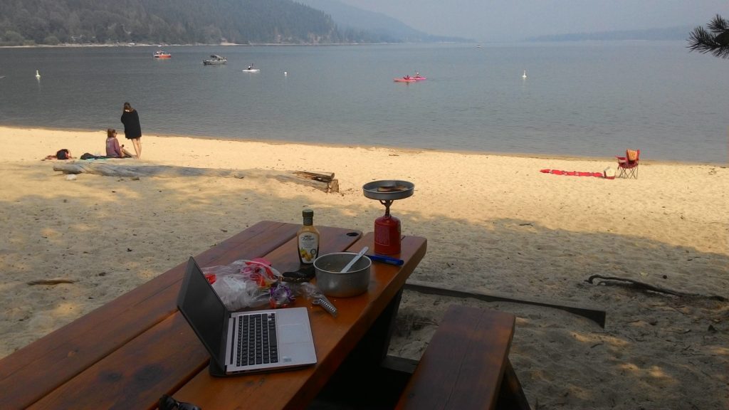
Who actually wants to have lunch in an air-conditioned hotel saloon if it can be in such a setting?
I spent quite a while here on the beach and even met two German girls who where visiting their cousin here. They came from Ulm quite close to the region where I was growing up. We chattet a little about the area, the wildfires, and traveling and then they went their way. I worked a bit on my blog and finally continued on my way to Nelson.
Nelson itself is a nice little town which I explored wandering down the main street and quickly stopping within the park. But then, I continued on my way as it was already late and I wanted to find a real campground today. I wanted to have a shower available in the next morning after the camping in the wilderness the last night. In the visitors center of Nelson, they recommended me to head to the Karibu Park Cottages close to the town of Winlaw. That said, I hit the road again…
Arriving at the Karibu Park Cottages, there was nobody in the office for doing the registration. However, the front door of the office was laced with notes about how to proceed in this case – only that all of them were kind of contradictory. However, I tried all means and eventually followed the note to just pick a site and do the registration later. On the neighboring site, I met a couple of “Hippies” who where traveling with their “Hippie Bus” since May this year. They told me that the owners of the campground were kind of easy going, so it should be fine to come back to them later. I chattet a bit with them and then set myself up on my site. Then I left a note at the door of the office and used the WiFi in a little pavilion – actually the only place on the campground with at least less mosquitos, and there were quite a lot of them around! During the entire process of searching for the campground owners, I caught already a significant number of bites and decided to buy myself a mosquito repellent as soon as possible.
However, this evening, I used the WiFi quite a while until it became dark. Eventually, the owners of the campground showed up and I made my registration. For dinner it was too late when I actually realized it and so I just went to bed in my car.
Sunday August 12th, 2018 – approx. 415 km today – approx. 1279 km total
During the night, the rain seemed to have stopped, and after getting up, enjoying a shower again and having breakfast, I just had to clean my dishes before continuing my journey. Unfortuntately, in the meantime it started to rain again – and even not just a little, but quite heavily.
I still left the campground and drove the short way to the town center of Banff. There, I stopped at the visitors center to ask about the weather forecast and the situation of the wildfires. I had checked the weather forecast already in the internet and to what I could see there, it was supposed to continue raining today and clear up a bit the next days. So at this point, I doubted my plans to continue on the Icefield Parkway since the visibility was that much impeded that I would most likely not be able to enjoy the majestic views of the Banff and Jasper national parks. The rangers in the visitors center told me that the road down to Radium Hot Springs has been opened again today, so another option made its way into my mind…
Back in the car, I studied maps and guidebooks and finally came to the conclusion of chaning my plans a bit: I would first leave Banff and Jasper national parks aside and drive down to Radium Hot Springs. From there, I would pass through Cranbrook and Creston to then drive northbound along the Kootenay lake to Revelstoke. This journey would take me a couple of days and afterwards, I hoped the wildfire situation had calmed down a little until then, so that I could visit Banff and Jasper national parks then with better visibility. Decided that, I filled up my food supplies in a local supermarket and the tank of my car at one of the only gas stations in Banff and then hit the road again.
On my way to Radium Hot Springs, I saw the helicopters with water buckets fighting agains the wildfires. A lot of side roads to the highway where still closed and one could see all the ranger activities to gain control over the situation. I even had my first animal encounter when a moose was grazing along the highway. Unfortunately, I could not stop to take pictures as there was quite some traffic on that side of the road and behind me. But I still hope that this was not my last animal encounter here in Canada!
The rest of the drive passed by without much attractions. I stopped a couple of times, once in a rest area to have a salad for lunch. Again, the rest area was nicely prepared with restrooms and a beautiful view to a lake – if there was not the smoke of the wildfires :-(.
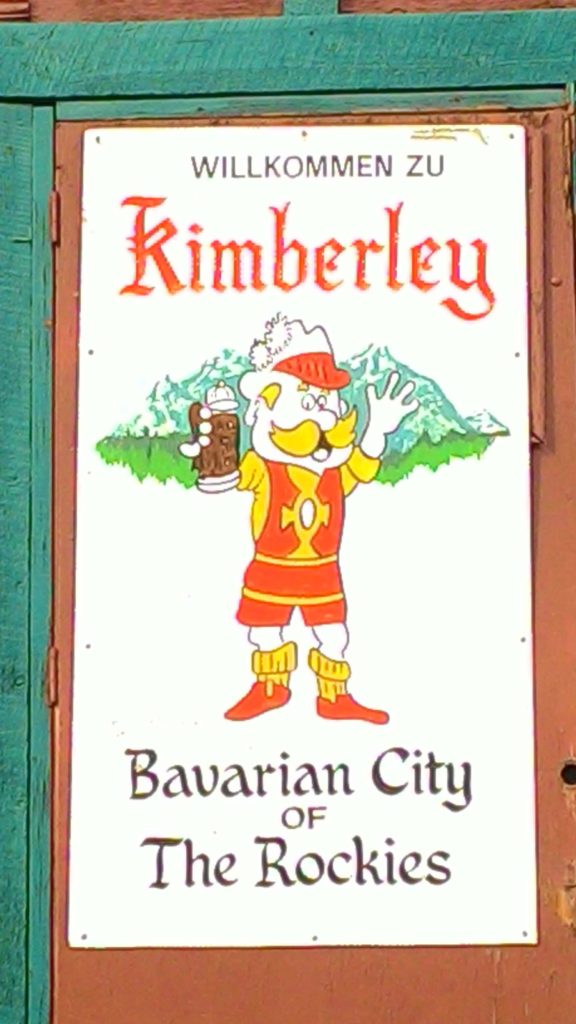
Further down the road, I stopped again in Kimberley, a little town which claims to be bavarian.
And indeed the short pedestrian street was designed like a cliché bavarian town. However, they apparently did not get the real difference between the Black Forrest and Bavaria: On the square called “Platzl”, there was a huge “Kuckucksuhr” :-).
After leaving Kimberley, I passed through Cranbrook which was of no particular interest to me and stopped for some Parmesan cheese in Creston. From there, I continued to the Duck Lake south of the Kootenay Lake where I wanted to look for a place to stay the night. On my way, I passed a lot of campgrounds and RV parks, but now that I needed a place to stay, there was nothing anymore. So I decided to check out the area of the Duck Lake for a possible place to stay in the wilderness. And voilà, I found a place to park my car on a tiny little stretch of land literally separating the lake into two. So there it was: My next premier experience: Spending the night in the car in the wilderness without any infrastructure!
I prepared myself pasta with tomato sauce and Parmesan cheese which was quite a challenge because of the tough wind that impeded cooking with my gas stove a little. However, I managed it and enjoyed dinner. Thanks to the still available mobile network, I was even able to talk quite a while with my wife back there in Toronto which I enjoyed a lot since I was without signal in the Kananaskis area.
Saturday August 11th, 2018 – approx. 200 km today – approx. 864 km total
My plan for today was to do the Rawson Lake Trail which was recommended to me by the rangers in the visitors center yesterday and which I discovered on my short walk yesterday. So I tried to get up not too late – but well, until having breakfast and finally getting ready it still was about 10 am in the morning.
I made my way back to the parking lot where I also stayed yesterday afternoon. There, I put on my hiking boots, my belly bag with some supplies, and my “weapon belt” with my camera and the bear spray attached :-). Then, I set off for hiking up to the Rawson Lake in the mountains south of the Upper Kananaskis Lake.
The trail climed quite steep uphill for a while leading through the alpine forrest. In the beginning, I tried to be as noisy as possible to threaten away some possible bears, but when I finally noticed that there were quite some other people on the trail, I figured that there wouldn’t be any bears surprising me behind the next corner and I relaxed a bit.
On the way, there where some explanation boards posted which gave some interesting details about the landscape, the forrest, and it’s flora and fauna.
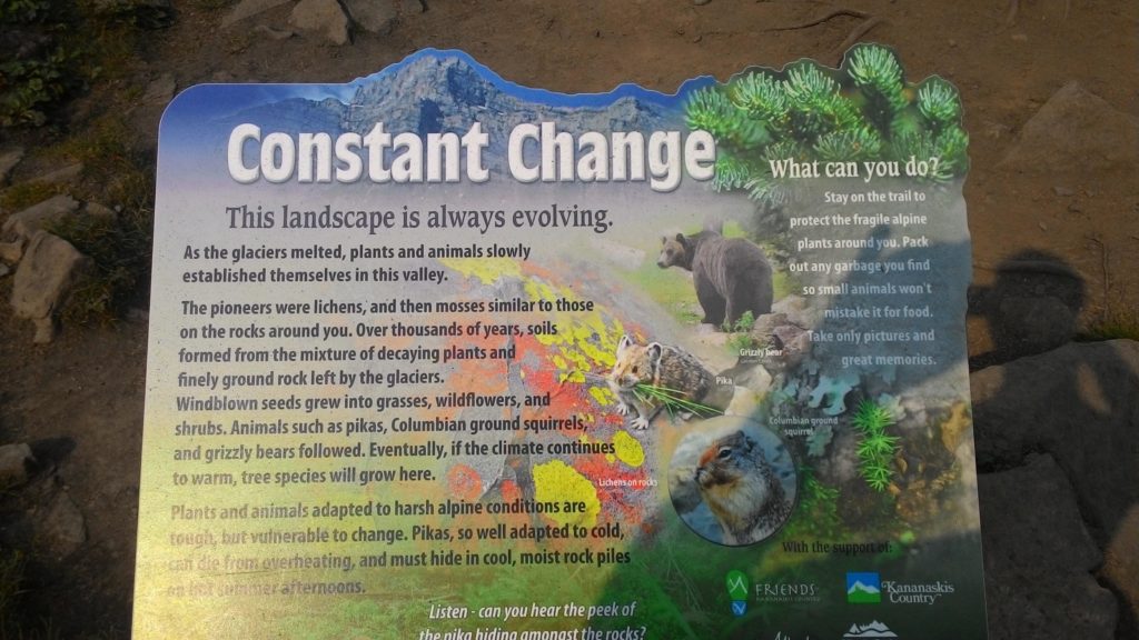
This is actually something, I really like about the North American parks: Everything is nicely prepared with explanation boards, simple but clean infrastructure (such as restrooms, benches, etc.), and extraordinarily friendly staff in well prepared visitor centers sharing valuable information about activities, incidents, and any other stuff to know about the respective region.
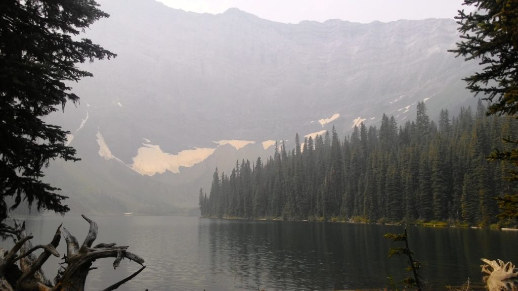
After about one and a half hours climing uphill, I reached the Rawson Lake. And yes, it was just beautiful up there – even if the smoke from the wildfires in British Columbia still significantly limited the visibility. I spent some time up there walking along the shoreline of the lake and taking pictures. I even encountered those little creatures again of which I took pictures yesterday evening. This time, they seemed to be almost not afraid of humans and approached me up to a few centimeters. Maybe they even would have touched me if I myself had not been to afraid and chased them away as soon as they came too close.
At around 12:20 pm, I started my descent down to the parking lot where left my car arriving there after about an hour. Since the entire hike exhausted me quite a bit, I decided to take a quick swim in the lake which again was terribly freezing but well refreshing after the just accomplished physical activity. Before hitting the road again, I prepared myself some sandwiches and enjoyed them on a bench at the shoreline of the lake. The entire beach was quite crowded today.
Back in the car, I went back to the highway 40 and drove it further down south until the Highwood pass. On the way, I quickly stopped for the short Rock Glacier trail which again had some interesting explanation boards about the transforming landscape and the flora and fauna posted. From the highest pass of the region, the Highwood pass, one should have a nice view on the surrounding mountains. Unfortunately, the smoke of the wildfires still impeded the visibility.
From the Highwood pass, I started a long drive all the way back to the junction of the highway 40 with the Smith Dorrien Trail, a gravel road to the town of Canmore. With a couple of foto stops, I drove that trail all the way up to Canmore in about 2 hours. Shortly before reaching Canmore, it became quite dark and a thunderstorm seemed to pass by. It also started to rain a bit which was not too bad as my car became quite dirty from the drive on the gravel road.
When I reached Canmore, my first intention was to look for a campground there. But then, I reconsidered it and continued on the Trans-Canadian-Highway to Banff, that famous town of the corresponding National Park which I wanted to visit during the next days. Since it was anyways raining, my idea was to continue driving a bit and save time tomorrow when it hopefully would clear up again.
Close to Banff, I managed to get the supposedly last site on the Two Jack Lakeside Campground. There, I made my first experience with camping in the car during a rainy environment. But it worked out better then it sounds and I was even able to enjoy a dinner without becoming wet:
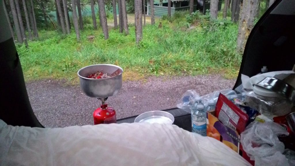
So I’m even prepared for worse weather conditions – which might await me in the Yukon…
This night, I slept quite well after the hike in the morning and the long driving afterwards. For tomorrow, I planned to visit Banff and start my journey on the Icefield Parkway towards Jasper.