Friday September 7, 2018 – approx. 199 km today – approx. 9.292 km total
… coming soon … due to a lack of internet access in Alaska, I’m unfortunately way behind with my blog …
Friday September 7, 2018 – approx. 199 km today – approx. 9.292 km total
… coming soon … due to a lack of internet access in Alaska, I’m unfortunately way behind with my blog …
Thursday September 6, 2018 – approx. 84 km today – approx. 9.093 km total
… coming soon … due to a lack of internet access in Alaska, I’m unfortunately way behind with my blog …
Wednesday September 5, 2018 – approx. 178 km today – approx. 9.009 km total
… coming soon … due to a lack of internet access in Alaska, I’m unfortunately way behind with my blog …
Friday August 31, 2018 – approx. 131 km today – approx. 6.708 km total
Since I had decided yesterday not to drive all the way to Whitehorse, but stay overnight on that rest area along the highway, I had to finish the last part of the journey today. But that was only about one hour driving.
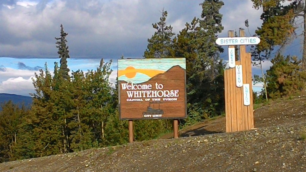
In Whitehorse, I first of all went to the RV park with which I already had made a reservation from Watson Lake. I checked in, got onto my site, and enjoyed a shower. After all those days staying on provincial park campgrounds, rest areas, and somewhere in the wilderness, it felt just awesome to have a real shower again.
Then, I went to the city and directly to the visitors center. There, they confirmed the advice that I had received in Watson Lake already to do the loop via the Top-of-the-World Highway, Haines, and Skagway the other way around due to the season coming to an end already. So I checked again with my already booked ferry from Skagway to Haines and finally decided to cancel the booking and follow the advice of the visitors center staff.
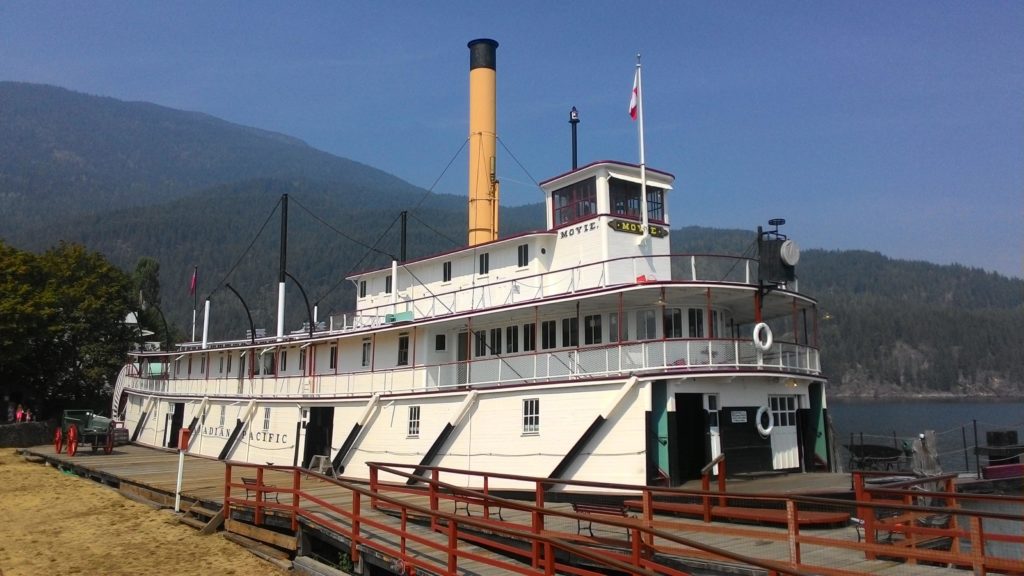
In addition to that, I got some hints of what to do in Whitehorse. First of all, I checked out the S.S. Klondike, an old sternwheeler presented at the entrance of downtown. I entered the old ship and took a look at its interior. It was quite interesting, but also nothing that spectacular. I mean, I have been on a couple of ships already – even if not yet on a sternwheeler ;-).
After that excursion, I decided to get myself something for lunch. To not end up at some of the junk food palaces, I tried a Canadian/German butchery and delicacy store. They offered sandwhiches which were actually quite delicious.
The other hint was the Millenium Trail leading all the way along the Yukon river down to the fish ladder helping salmons to pass the hydroplant dam on their upstream migration. However, I somehow did not feel like walking all the way and back. Somehow, I did not feel completely good today. Maybe it was because of limited and somehow disrupted sleep last night. So I decided to drive over to the fish ladder. I entered the building and was told that there was no salmon at the moment. However, I could visit the construction and when I returned on my way back, one salmon had entered the facility. I was told that the staff usually waits for a couple of salmons, registers them, and opens the gate for them then. However, sometimes, they take out selected salmons and use them in the fish hatchery to raise new salmons. This particular guy that had just entered the facility seemed to be one of those candidates. I was shown the different states of salmon eggs and given some further explanation about the hatchery.
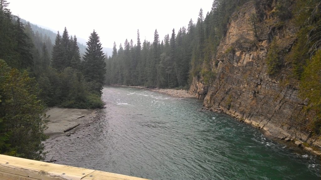
After that stop, I drove the Miles Canyon Road which was recommended in my guidebook. However, it was not really that special. At two designated viewpoints you could enjoy the view onto the Yukon river, but the rapids which gave the city its name were no longer there.
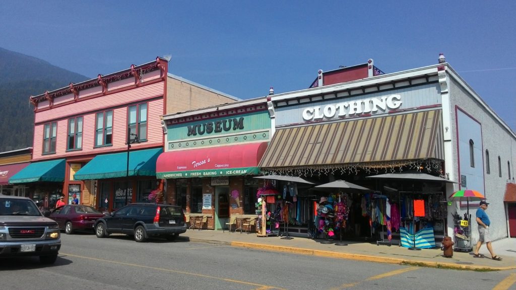
I finally returned to the city and just walked a bit along the main street and checked out the souvenir stores. I even found something, but the city itself did not offer that much more for me. I’m not that into museums of which there were quite a couple here. So I chose to just walk along the riverside a bit and finally returned to my car. Since I did not feel that good today, I simply left it with a kind of “slow day”.
In the evening, I went to the Canadian Superstore and Walmart to fill up some supplies, as well as the gas station and finally returned to the campground. There I prepared myself dinner and did my laundry. All in all it was a quite unspectacular day – of which you simply need one every while and then when traveling for a bit longer period.
So now, I finally managed to update the map of my route. I struggled a bit with the limitation to 10 layers on the free Google Maps version. However, I found a way which should work for this trip.
And here it is even embedded into a blog post. If you click the small rectangle symbol in the upper right corner, it will open in a separate tab or window.
You can even find this map now at any time in the left main menu below Traveling – Canada 2018 – Route Map.
Monday August 20, 2018 – approx. 207 km today – approx. 2.759 km total
Coming soon …
Sunday August 19, 2018 – approx. 65 km today – approx. 2.552 km total
Coming soon … stay tuned, it’s going to be incredible!
Sunday August 18, 2018 – approx. 47 km today – approx. 2.487 km total
Today, I just spent almost the entire day on the Peace Arch RV campground doing my laundry and some office work. I checked my mails, did my accounting, and updated my travel plans. Nothing special to report about.
The night I spend on the Tsawwassen Walmart parking lot – by the way together with a lot of other RVs and campers – since I had to be at the ferry terminal early in the morning to sail over to Vancouver Island.
Friday August 17, 2018 – approx. 56 km today – approx. 2.440 km total
Coming soon …
Tuesday August 14, 2018 – approx. 645 km today – approx. 2084 total
After getting up this morning, I was glad having a shower available at the Karibu Park Cottages campground. Ather that shower, I proceeded as always with my selfmade breakfast: Oatmeal with fruits, coffee and orange juice. Also the cleaning up after any self prepared meal already follows the same procedures.
Once I got ready, I left the campground and turned onto the highway 6 again to follow it along the Slocan river and the subsequent Slocan lake all the way to New Denver. There, I turned right into the Selkirk Mountains towards Kaslo. On the way, I was even able to refill my water supplies in a wild stream rushing down the mountains. This already became one of my common procedures: I recycle old water bottles of bought drinking water by filling them with fresh water wherever possible and use it for cooking and cleaning dishes when staying in remote locations.
Arriving at Kaslo, I strolled a bit through the little town and enjoyed an ice cream.
Then, I bought myself a salad for lunch and headed further north – now again along the Kootenay Lake. Somewhere at the tip of the lake, I found a place to stop and have lunch. Actually that was really necessary as I felt hungry by that time.
After lunch, I continued on my way towards the Trout Lake and finally the city of Revelstoke. The highway 31 turned into a gravel road shortly after the northern tip of Kootenay Lake, but from the Smith Dorian Trail in the Kanaskis area, I was already used to drive that type of roads. However at the southern tip of the Trout Lake, I found some boards explaining that this region is a real bear country since at certain seasons of the year there are trouts and salmons in the stream feeding the Trout Lake. Unfortunately, I was not lucky enough to spot one of them.
However, the way from the southern tip of the Trout Lake to Galena Bay was real fun to drive: The gravel road kept going up and down and it felt like a ralley already. I really enjoyed that part of the trip – hehe ;-).
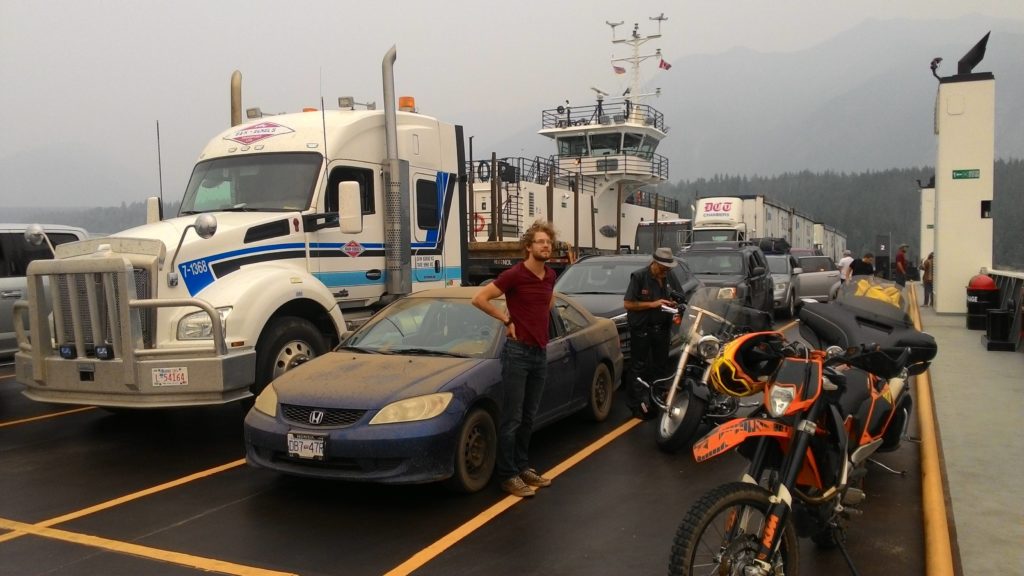
In Galena Bay, I boarded another ferry which took me to Shelter Bay where I somewhat returned to civilization after the remote area of the Trout Lake.
After disembarking the ferry, I checked the time and my travel plans. To that point, my idea was still to stop in or close to Revelstoke and on the next day return into the Rocky Mountains to try my luck again with the smoke of the wildfires. Now, that I actually almost arrived in Revelstoke, still had some time left this day and figured that the smoke situation had not significantly improved, the idea grew in my mind to continue towards Vancouver and leave the Rocky Mountains for the very end of my Canada 2018 roadtrip.
Before fixing that idea, I decided to first continue the final part up to Revelstoke and take the final decision there. The drive was not at all special and after about half an hour I arrived in Revelstoke. Stopping at a gas station, I once again checked my schedule and finally decided to follow that new plan. Since I still had a couple of hours left of this day, I even decided to drive on towards Vancouver and look for a place to stay the night on the way.
So I continued on the Trans-Canadian-Highway which actually did not feel that much of a trans-something-highway for the first tens of kilometers. It was more a mountaineous road going up and down along a deep valley. Since back in Revelstoke I decided to not fill up the car, I was in real need of a gas station soon and had to stop at the next one showing up along the way. With the car refilled and ready to hit the road again, I continued until around 10 pm when I finally became too tired. I managed to find a Wendy’s to have something to eat and chose a nearby rest area in MapsMe where I planned to spend the night.
However, somehow I missed the exit or MapsMe was wrong, so I even had to continue about 60 km more until I finally reached the Britton Creek rest area where I parked my car and fell asleep quite quickly.