Snow in the Rocky Mountains

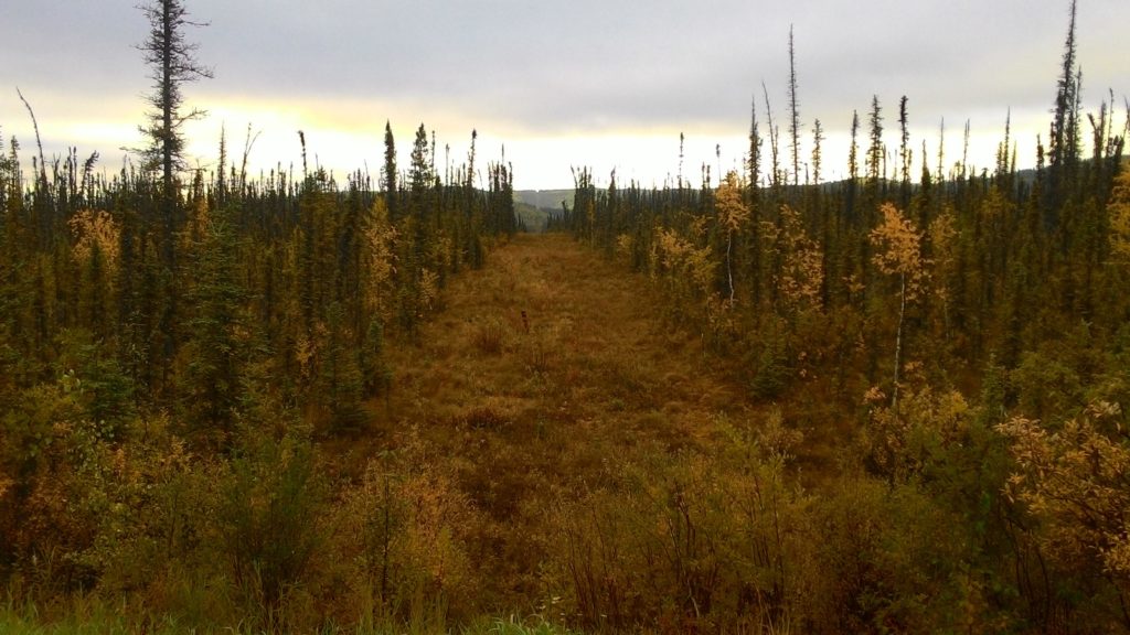
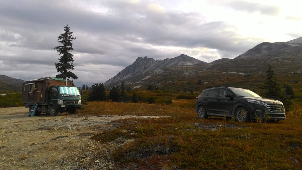
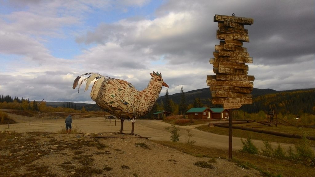
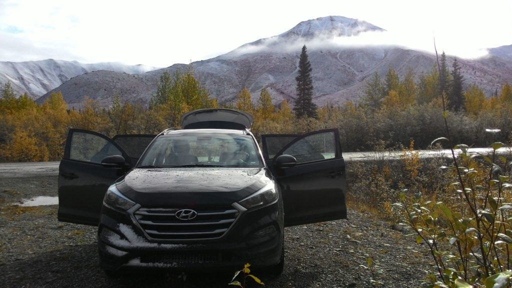
Wednesday September 12, 2018 – approx. 113 km today – approx. 11.483 km total

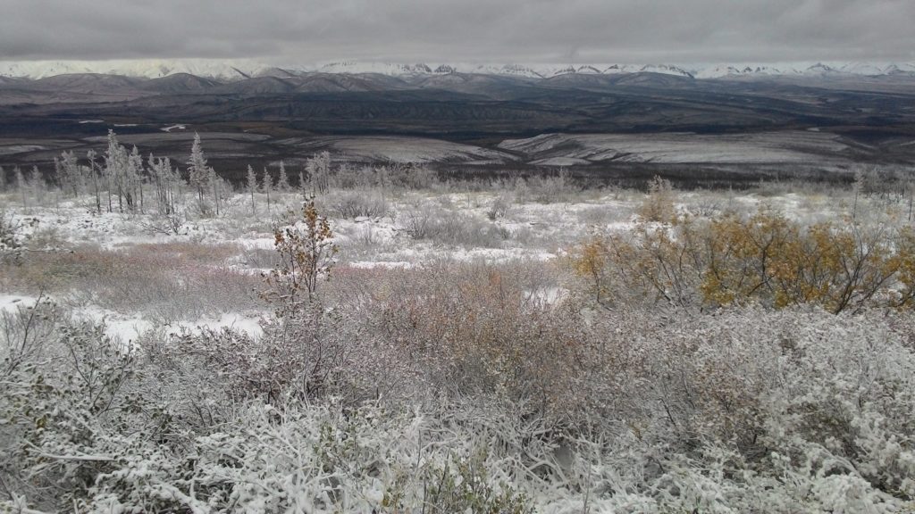
This night, I woke up a couple of times. I actually don’t know why, but with being awake for some time, I realized that it had indeed started to snow a bit. In the morning there was a slight layer of snow and ice on the trees and plants around my campsite. And it was freezing cold. Again, I enjoyed the hot shower for which I had to walk even further than on the Whistlers campground yesterday. I don’t know: Maybe, I simply didn’t get the system of drive-thru showers ;-).

After breakfast, I started driving down the Icefield Parkway. My plan was to split the drive down to Lake Lousie into about three parts. I would then reach Lake Lousie on Thursday evening, maybe spend Friday there and drive to Vancouver on Saturday. The only thing that might impede my plans was the fact that it was still snowing – even more heavily now.

My first stop was the parking lot of the Valley of the Five Lakes. My travel guide and also the staff in the Jasper visitors center declared the 4,5 km loop trail there as beautiful, so I wanted to give it a try – even though it was still snowing. I tried to get myself as warm as possible with the limited clothing I had packed for this trip. In fact, I was not really fully prepared for that kind of weather since I had not expected snowfall!

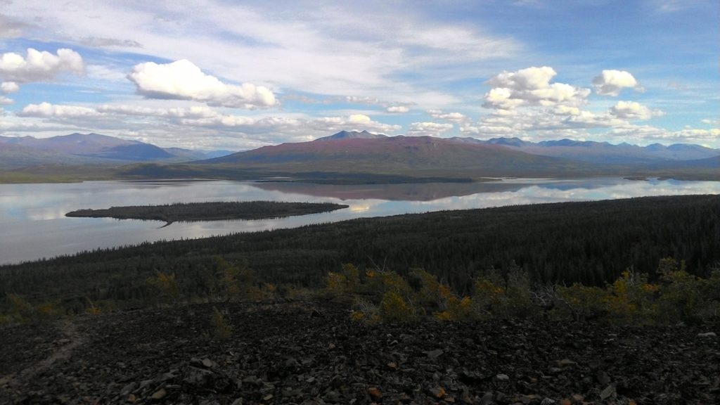
The trail led through the forest and climed uphill a bit. After a while, it reached the fifth of the Five Lakes. The scenery with the snowfall was beautiful, but once again, it was just a lake and nothing that spectacular. Probably, I simply had too many much more spectacular impressions on this roadtrip to value it sufficiently.

The trail passed the forth, third, and second lake one after another and then turned into the woods again for returning to the parking lot. In the meantime it at least had stopped snowing and I continued to drive along the Icefield Parkway.

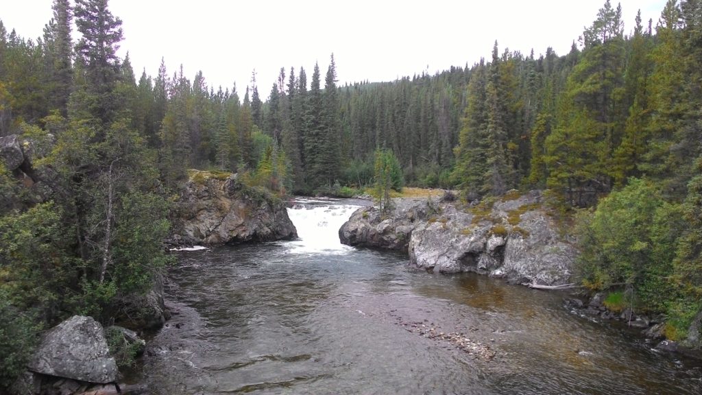
My next stop was just about 20 min further down the road: The Athabasca Falls. From the parking lot, there was a short well-prepared walk that took me close to the falls which indeed were fascinating. I spend some time there taking pictures even though it had started to snow again. I even walked along the trail a bit into the canyon but eventually, I became too cold and returned to my car.

About another 20 min further down the Icefield Parkway, there was another waterfall where I also stopped. It was also impressive and I spent some time there again. However, it was the same story: Eventually, it simply was too cold to stay any longer.

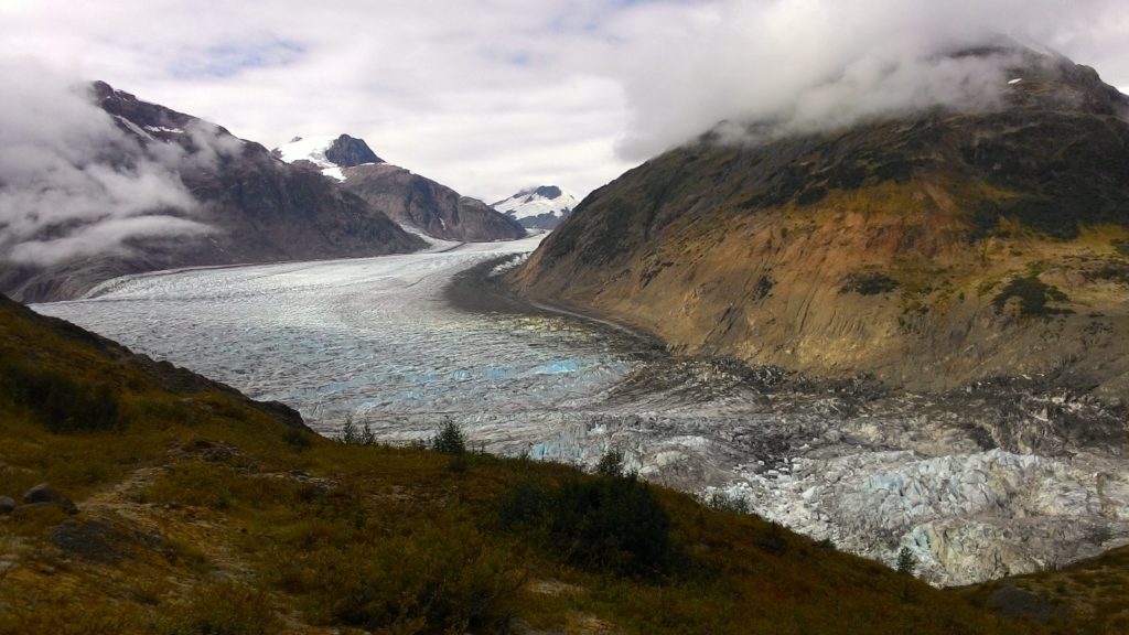
After the two falls, my major destination for today was the Columbia Icefield. It is a huge glacier icefield located behind the mountains visible from the Icefield Parkway. Actually, only three of its glaciers are visible from the road: The Athabasca, the Dome and the Stutfield. Right at the toe of the Athabasca glacier, there is the Columbia Icefield Discovery Centre – and that’s exactly where I went first. In the center there is an exhibition about the glacier melting and what it means for the Columbia Icefield and in addition a movie is shown. The latter in fact surprised me a bit: I had expected an educational movie explaining the phenomena of glaciers and the glacier melting. However, it was actually a really well done movie with just music and moving action. The characters were three children who were playing in the area of a glacier. One child found a nicely carved and colored stone and took it. When becoming older, that same child did excursions on the glacier ice and once that stone that he always carried with him fell off his pocket into a glacier crevasse. The movie was mixing the timelines with one and another and there was a third timeline where an old man hiked in the region of the glacier and admired it – that old man was of course the child grown up. Eventually the old man found the stone that he had picked up when being a child at the toe of the glacier. He took it and put it back in the same location where he had picked it up as a child. So the movie kind of showed a circular story and expressed the ever ongoing cycle of nature. I was wondering the entire movie when there would be some explanations, but I simply could not leave since the entire scenery shown was so beautiful. Only at the end one finally got the point of the entire movie. It was really well done.

After watching the movie, the weather had cleared up a bit, and I hurried to drive over to the toe of the Athabasca glacier. From the parking lot, I had to walk and climb a bit up and reached a plateau from where I could watch the toe of the glacier. It was maybe a couple of hundred meters away and really an impressive scenery. In addition on the trail, signs posted the location where the glacier toe had been in certain years and one could really feel the glacier melting while hiking up there. It was impressive.

It turned out that I had catched exactly the right moment for getting up there to the toe of the glacier. Just about half an hour later, clouds were again covering the icefield and I returned to my car.

Now, I was a bit unsure what to do: Should I stay here and wait if tomorrow the weather would be better, or should I continue towards Lake Lousie. I finally decided to stay and started driving to the nearby campground. But then, I wondered if I could not just stay on the parking lot of the Columbia Icefield Discovery Centre. So I returned there and asked an employee of the restaurant since in the actual Discovery Centre nobody was present anymore. She explained me that I could stay on the parking lot, but had to pay 15,70 $ at a self-registering booth. However, the washing rooms in the Discovery Centre would be opened the entire night. So actually, the parking lot was even the better camping location than the campground which would most likely just have pit toilets.

I went over to the self-regsitering booth, did the registration, and returned to my car. Then, I grabbed my notebook and went into the Discovery Centre as it was of course much warmer there. In the meantime it had again started to snow – and this time really heavily.

When I finally returned to my car at around 9:30 pm, about 5 cm of snow covered everything outside – including my car. I really did not feel like doing some cooking action anymore and decided to just go sleeping without dinner.

(Unfortunately, I still cannot upload any pictures anymore… I don’t know what’s wrong, but will most likely fix that problem later.)

In the Region of Jasper

Tuesday September 11, 2018 – approx. 124 km today – approx. 11.370 km total

When I woke up this morning, it was quite cold. So I really enjoyed the hot shower on the Whistlers campground – even though I had to walk quite a while for it. The campground was huge and there was only one shower building.

After breakfast, I drove into the town of Jasper and directly to the visitors center. As usual, I got valuable information about what to do in the region. My first destination was the Maligne Lake. The drive there would take about an hour and so I started going. Just after leaving the town of Jasper, a lot of cars and people were on the road again on the same spot than yesterday shortly after the spot where I had seen the elks. A black bear had shown up again which was there yesterday already. However, it was really far at the tree line on the other side of the road and I could not see it. On the other hand it did not bother me that much: I had seen black bears and even grizzlys much closer than this one here. However, I chatted a bit with one of the other tourists and eventually continued my drive towards Maligne Lake.

Shortly after leaving the major highway, the road towards Maligne Lake passed Maligne Canyon and I stopped there to take a short walk along the well-prepared trail. My yesterday’s impression when entering the national park intensified today: Even though the season was coming to an end, the park was still crowded. The parking lots were almost full and on the trails there were a lot of people. I was greeting someone and received greetings basically every couple of seconds. This and the amazing infrastructure efforts somehow destroyed the feeling of being out there in the nature. And as with the black bear back there on the highway, people here were completely crazy about a single animal somewhere far away in the bushes while further north in the Yukon and in Alaska one could watch bears and other animals from a much closer distance…

The Maligne Canyon was beautiful, but also nothing that would beat what I had seen on my roadtrip so far. On my further way to the Maligne Lake, I also passed the Medicine Lake but since the parking lot was quite crowded there, I decided to give it a try on my way back.

At Maligne Lake, I parked my car – again on a completely crowded parking lot – and started walking along one of the trails following the shoreline of the lake. It was a nice walk with some beautiful view of the lake – but again, it was nothing that could top my so far experiences. When the trail turned away from the lake and into the woods, I turned around and went the same way back to my car.

In the meantime it was already noon and I decided to have lunch on one of the benches at the shoreline of the lake. Lukily, I finished my lunch before it starting raining a bit and since I did not expect the other trails around the lake to be that much different from the one I just walked along a bit, I returned to my car and started to drive back to Jasper.

On the way, I stopped a couple of times for taking pictures – especially at the Medicine Lake and eventually reached the town of Jasper again. From there, I directly continued to the Patricia and Pyramid Lakes north of town. There, I decided to take a longer walk and went up the hill on one of the designated trails. The trail climed up quite steep and after a while, I doubted if that was worth it. But asking some other tourists on their way back, I got the confirmation that it was and so I continued. And indeed: Just a bit later, the trail reached a little plateau from where I had a wonderful view on the two lakes and even the town of Jasper.

From the plateau, the trail led into the woods again and took a long detour on its way back to the parking lot at the shoreline of the lakes. When reaching the road again, I spontaneously decided to walk over to the little island in the Pyramid Lake on another short trail. When I reached the island, it started to rain quite heavily and I had to take shelter for a while. But lukily it was just a short shower and once it was over, I could walk a bit around the little island and take some pictures of the lake and even the mountains beyond it.

In the meantime, it was evening already. I drove back to town and shortly went into the local supermarket and the gas station to buy salad kits for the next days and fill up my car. Surprisingly, the gas was quite cheap here! I then decided to give the third short hike to the Old Fort Point at least a try – and I was completely right with that: From the parking lot the trail climed up steep until reaching a huge rock. From atop, I had an even more beautiful view to Jasper and the valley then from the longer hike I had just completed. There was even a rainbow showing up and the entire scenery with the rain clouds and the sun beams through them was quite beautiful.

Eventually, I decided to stop it for today and drove to the Wapiti campground just a couple of kilometers further down the Icefield Parkway. There, I prepared dinner and got myself ready for the night.

(Again, I currently do have problems with uploading my pictures. So they will be added at a later point in time.)

A Monster Journey

Saturday September 8, 2018 – Monday September 10, 2018 – approx. 1954 km in three days – approx. 10.701 km total

Slowly but steadily, my roadtrip in Western Canada unfortunately comes to an end. There are nine days left until I am going to return my rental car which has served so faithfully in Vancouver city and catch my flight back to Toronto. Until there, almost 3.000 km of distance lie ahead of me… a distance of which I want to cover most of it in the next three days. Actually, I am going to even take a little detour for that: From Whitehorse, I am going to drive down to Jasper in the next three days, not stopping that much for any sights or activities. From there, I am going to explore the Rocky Mountains for about four days since I missed that region completely in the beginning of my roadtrip because of the wildfire smoke situation, and then my plan is to drive the remaining 700 km to Vancouver city in one shot on Saturday September 15.

That said and planned, I started Saturday morning from the Walmart parking lot on the Alaska Highway towards Watson Lake. On the way, I just stopped for the cinamon buns at Jakes Corner. For that there is also not that much to tell about the journey.

In Watson Lake, I stopped by the visitors center to get recent information about my route lying ahead of me. And as always, I got really a lot of information about stops and activities along the way to Fort Nelson. I was also confirmed to definitely stop at the Liard River Hot Springs which I actually planned as my first overnight stop. In Watson Lake, I also took a little rest to recover my forces and driving capabilities.

Then I basically continued without major stops all the way to the Liard River Hot Springs where I used the facilities and enjoyed the relaxing hot water. I also prepared dinner there and then drove on a little bit while searching for a place to stay overnight. I really did not want to pay for the park campground at Liard River Hot Springs which anyways had no facilities except pit toilets.

On the further way, I encountered these guys here a couple of times. I actually had seen them already shortly before reaching Liard River Hot Springs.

(Picture will be added later…)

Finally, I found a really good spot to stay overnight: A forest road which I just followed a couple of meters to be a bit hidden from the Alaska Highway. There I parked my car along the road and after finishing some blog entries directly went to bed.

Unfortunately, I did not sleep that well that night and woke up quite early. But somehow, I did not feel like hitting the road right away and took it quite easy. At around 7:30 am, I got up, prepared breakfast, and got myself ready to go on.

The todays journey took me through the northern tongue of the Rocky Mountains. But unfortunately, it was quite cloudy so I could not really see the mountains that well. Just on the Summit Lake, I saw one snow capped mountain through a whole within the clouds for a couple of seconds. But it was really not for taking any picture.

The road was quite winding on that part of the journey so I was not able to recover the average speed I had driven the day before. With a bit better weather however, the landscape would surely have been really scenic. But with all the clouds and fog, I could unfortunately hardly see anything of the mountains. Hopefully, this will be different down there in Jasper!

At around noon, I arrived at Fort Nelson. There, I took a break writing these lines and filled up my car. Then I hit the road again and drove further towards Taylor which was my today’s chosen destination. The road was now quite boring: Mostly just straight ahead for many kilometers in a row. Then eventually a curve and once again straight ahead for another couple of kilometers. What was interesting was the change of landscape since I had arrived in Fort Nelson. From the mountaineous area, it changed to prairie and farm land. Every once in a while I could see some kind of gas or oil pumping installations where most often a flare was burning. I am not sure if this was actually part of the famous Alaska Pipeline which I read would accompany the Alaska Highway for many kilometers. However, apart from those installations, I did not see any typical pipeline following the highway.

Eventually, I reached Taylor and since I still felt ok with driving, I decided to continue a bit. Dawson Creek would be the next larger town, and it was just a couple of kilometers further down the highway.

Once I reached Dawson Creek, I had enough of driving. Since I had to fill up some food supplies for probably the last time on this roadtrip, I went directly to the Walmart Supercentre and also asked there about staying the night on the parking lot which was accepted. Somehow I felt too lazy for cooking tonight, so I just went to the A&W burger shop nextdoor to the Walmart and finally returned to the parking lot for getting myself set up for the night.

The next day, I continued my drive down to Jasper early in the morning. Since I was somehow back to civilization, I even had cell phone and radio signal for most of the trip. And that gave me the possibility to listen to the local news. What I heard there, gave me a little shock: There was snow expected in the Rocky Mountains on Wednesday! I was a bit concerned about that since I did not know if I had winter tires on my rental car. So I stopped at the visitors center of Grand Prairie where the staff – as always – helped me in a very friendly way: They called my rental car agency for me and I was able to get the information from there that all cars are equipped with All-Season-Tires, so I should be fine. I even got some further information about the remaining part of my trip to Jasper and a recommendation of stopping in Hilton and visit the Beaver Boardwalk.

On my way to Hilton, I unfortunately had a bad experience with the road conditions here in Canada: When an opposing truck passed me, a small stone hit my windshield and caused a significant damage in it. Since I was unsure what to do, I stopped in Grand Cache and called the 24 hours Roadside Assistance. However, they were not really able to help me and advised me to either check with a local police station whether it was safe enough to continue my trip or call my rental car agency in the Calgary airport from where I took the car. I tried the latter but was waiting in line for more than 30 minutes. Thus, I continued my trip and further tried to reach them in parallel. Finally, shortly before reaching Hilton, they answered their phone and told me that I can go on and just had to inform the staff at the rental car location in Vancouver when I return my car about what has happened. So that issue was settled.

In Hilton, I directly went to the Beaver Boardwalk. Unfortunately, it had started to rain in the meantime. Since it was not too bad yet, I hurried to get on the boardwalk and did a loop through the swampland area. I could see the huge beaver dams, but unfortunately all of them were hiding – I mean, I would do the same with the rain if I were a beaver ;-).

When it started to rain more heavily, I quickly returned to my car and continued my drive into Jasper. Shortly after leaving Hilton behind me, the weather cleared up a bit and I was even able to enjoy the scenery along the way into Jasper a bit. I even stopped once to climb a hill and take some pictures. And then on my further way, I had to stop again: There were a lot of cars waiting along the road and people walking around and taking pictures. There were elks around. I stopped too and started taking pictures. After a while watching the elks, two young males even started to fight with each other while another older male was defending his herd of females. It was quite interesting to watch the entire action.

Finally, I reached Jasper and since it was already getting dark, went directly to the Whistlers campground to spend the night there. Wild camping is not permitted in National Parks and I did not want to get into trouble with the park rangers.

(I am currently having problems uploading my pictures. For that they will be added later, so return and check in a couple of days.)

An Awesome Encounter

Tuesday September 4, 2018 – approx. 531 km today – approx. 8.831 km total

Today, my plan was to enter Canada and on the same day leave it again into the town of Haines. So after breakfast, I drove the remaining few kilometers to the Canadian border. Entering was as easy as at the border control between Hyder and Stewart: Just the usual questions and that was it. The international border is marked here by an alley that has been cut into the forest and some markers and information boards. For me as a German this way of marking the border in the landscape appears a bit weired for historic reasons… but of course the idea is a completely different one here.

I continued driving towards Haines Junction and actually this journey through along the base of the Elias Mountains was probably one of the most scenic drives of my entire roadtrip. There were the omnipresent yellowish color of the transforming plants, some lakes, and behind everything the partially snow capped mountains. It was just awesome and I stopped a couple of times for taking pictures. The drive to Haines Junction should have taken about three and a half hours – I was on my way for at least five and a half because of all the stopping for pictures.

Finally, I reached Haines Junction. There, I checked the condition of the Haines Highway in the visitors center and went on towards the border to the U.S. again. On the way, I stopped at the Rock Glacier hiking trail and climed up the hill which was once a glacier. The short hike was quite difficult, but from up there I had a wonderful view over the entire area with the lake and the mountains reflecting in it. I met a German couple and we exchanged some experiences made here in Canada.

The second stop was for the Million Dollar Falls which were quite nice little waterfalls. A short trail led from the campground to the falls and a platform above them. It was nothing that special, but since no reasonable detour was necessary to see the falls, I simply took the chance.

My further way led me more and more into the mountains which form the natural border between Canada and one of the most southern tips of Alaska, where the towns of Haines and Skagway are located. The road slowly but steadily climed up and eventually reached a high plateau surrounded by the mountains. That was perfect for trying some panorama shots with the smartphone from a perfect location: Standing in the car, head out of the opened car roof ;-).

In the meantime it became late and since I had been driving a lot today already, I was really thinking about crossing the border to Alaska or leave that for tomorrow. Shortly before sunset, I reached two awesome spots on hills within the high plateau which I first of all just passed. But I noticed two campers sitting right on top of those hills and people enjoying the view from up there. One of those campers looked quite strange and I became curious…

So a few seconds down the road, I turned around and returned to that hill where I had seen the strange camper. I myself drove up the hill and realized that the camper looked like a wooden house sitting on a small truck. Two eldery persons were sitting in front of that camper chatting with two other people who had obviously also stopped for the strange looking of the camper. I approached the group and got into the conversation within seconds. A few minutes later, the other visitors left and drove on and I stayed there talking to the elderly man. I asked him about his camper and that was the beginning of a series of stories he had to tell.

His name was John and he had been living in sailboats and self-built campers like that one together with his second wife for almost 40 years. They had raised their kids virtually on the road, homeschooling them while being on their way through a sheer countless number of countries. John told me that one of their daughter has stamps of about 50 different countries in her passports! He told me stories about the different trips they were doing. In the beginning backpacking, then on their own sailboat and finally in those self-built campers. They live in Homer, Alaska but in the winter travel down to Mexico in their camper. And that was where they were currently heading – but definitely on their own pace: The journey from Homer, Alaska to here had taken them already more than a month since they travel about 60 miles a day and simply enjoy their time to the maximum.

When I asked John how he pays for all that, he explained me that he had been a contractor and made a good portion of money with that. He then invested that money at the stock market and – according to his own words – became quite rich. Since they does not spend a lot while living on the road, he can live of that money quite well together with his wife.

While telling me all those stories, John prepared a steak on a small outdoor grill attached to his vehicle. In the meantime, his wife was preparing the rest of the dinner indoors. Once dinner was ready, John excused himself for some time and invited me to join them later in their vehicle for watching some videos of their trips. While on the road, they process their videos and pictures of their entire life and produce short video clips of about one hour length. I was of course curious and so the decision of whether to cross the border today or not was made: I would stay here and spend the night in the car just next to my new friends.

While John and his wife Linda were having dinner, I had my own dinner in my car. Once John and Linda were ready, he came over and invited me to join them. The interior of their vehicle was amazing. Everything was nicely decorated and organized. They even had a TV and a DVD player built into the wooden cuboard on one side of their bed. John showed me some videos of trips they had made so far and the pictures were really awesome! Really close pictures of animals of all kind, bears, foxes, deer, you name it. And of course pictures of amazing landscapes they had traveled through on their trips. According to John’s own words, they really had been to remote places – and I had no reason to doubt any of those stories!

I spent the entire evening with John and Linda in their camper until about midnight. It was really difficult to say goodbye – especially because John went on and on telling stories about their life and their experiences. And those stories were just so great to listen to that I could hardly find a chance to leave and go over to my own car.

But eventually, I said goodbye – not before having asked for their contact details for keeping in touch. In addition, their were on their way to Haines, too and so we expected to see each other again there tomorrow or the day after. I went over to my car and directly to bed with a head full of stories and the amazing feeling of having met two really interesting characters with an even more interesting life! I could hardly fell asleep with all those stories in my mind and was full of admiration of their courage and happiness they were sending out! This was one of the most amazing encounters I have ever had on my trips so far!

On the Top of the World

Monday September 3, 2018 – approx. 415 km today – approx. 8.300 km total

For today, I planned a visit to a still working gold mine for the very morning and continuing my way towards Alaska on the Top-of-the-World Highway for the afternoon. Since I had to be at the tour office at 8 am already, I had to get up early. I still wanted to get my shower on the campground since it’s not that often that I have a chance for that. I even skipped breakfast to not loose too much time and not having to get up even earlier.

Shortly before 8 am, I arrived at the tour office. The guy there – another one than the one I talked to yesterday – sold me the ticket. A few minutes later, one of his colleagues and the tour guide for today showed up. And there was the surprise and disappointment: The tour guide was the same young lady who was doing the tour on the dredge yesterday and who was quite unfriendly. In addition it looked like as if I was the only one going on the tour – puhh, that would become a tough one. Well, I had bought the ticket already and anyways wanted to go on that tour. So I just decided to make the best out of it and fight unfriendliness with even more friendliness from my side. In case I would become too tough, I wanted to just ask her what kind of harm I did to her that she was so unfriendly with me.

Eventually, we got into the tour van and drove to the mine. That was about a half an hour ride and my guide simply did not talk to me at all. She hardly answered my questions and after two or three attempts to do some kind of conversation, I simply stopped and waited for what would happen at the mine.

Arriving there, my guide explained me a bit about the digging techniques at the current location where they worked this summer. In fact, the work had already been stopped for the season, so I could just see the digging area and the equipment sitting around silently. This was not exactly what I had expected, but well, sometimes those surprises happen.

One stop further, my guide explained me the recent version of a tumble used for separating the gold from the rocks and mud. Basically, it still works the same way as on the dredges, just much smaller. Today, they use excavators for digging and the tumble is a separated machine of about the size of two or three washing machines.

Another stop further, we entered an old house that was originally a shelter for the people working out here many days in a row without returning to the city. It was now some kind of a museum where they showed stuff that had been found while mining. Those were an old shoe, some technical equipment, and even – the most interesting one – two teeth of a mammut. My guide also explained me on a map how the claiming of territory works for gold mining. Actually, she seemed to wake up a bit and was not that unfriendly anymore as before. The territory claiming is really an interesting story: Basically anyone of any nationality can just come out here, find some unclaimed spot, do some analysis and claim property on it for mining. He would then return to the city, pay an administration fee of 10 bugs and get the right to mine for gold there. Once gold is found, the state gets two percent of the winning. As long as you continue mining on a certain territory, you have the exclusive right to do so. You just cannot build anything on that territory, but while mining you can bring a trailer home or whatever has got wheels to live in. This entire system seems so weired in the eyes of a European or even a German where everything is regulated and you cannot even change the color of your house’s roof without a permission.

The last stop of the tour was actually the most interesting one: I had the chance to pan for gold myself. It turned to be much more difficult than one might think even though the idea is simple: You use three elements, water, gravity, and agitation to separate the gold flakes from the dirt. Eventually you find tiny little flakes of gold of the size of much less than the head of a pin. With three attempts and help of my guide in the final steps of the work, I managed to get three of those little gold flakes. Even though the price of gold had raised enormously since the time of the gold rush, those finding won’t make me rich unfortunately.

This was anyways an interesting discussion I had with my guide before: Since I realized that she is herself involved in gold mining out here, I asked her how much is usually found or has been found during the past season. I just wanted to get an idea of the return of investment. Without actually answering my question, she explained me that this is the wrong way of thinking. In her opinion, the first think you have to understand for beeing able to survive the searching for gold is the system of randomness. You might find some valuable amount of gold one day and then go on mining for four years without finding anything. She explained the character of a gold miner as a mixture of a farmer and a gambler: The farmer’s outcome highly depends on nature, one storm, one harsh winter can destroy the entire year’s harvest. And the miner is also a gamber since he’s taking an enormous risk just to eventually become rich.

After that final stop, we returned to the city. There my guide simple dropped me in front of the office with a harsh “have a good day” and went away. Well, you can’t change people – some simply have their character. I spent some time, using the public washroom, filling up my water supplies, and trying to shop around for souvenirs – there was actually nothing I liked – and finally made my way to the ferry crossing the Yukon river for going onto the Top-of-the-World Highway.

Again, the road condition of that highway was much better than I expected from the fact that I was actually not supposed to drive it with my rental car. The road climbed up the hill and once I was finally all the way up, it indeed valued its name: It winded its way ontop of the mountains with occassionally almost bottomless drops on each side. Driving up there was indeed an experience since you felt like “god” overview the entire earth below you. However, having been on the Dempster Highway, after a while of driving, I did not seem that special to me anymore. The landscape was basically always the same – there was much more change of it on the Dempster Highway. The only change here was from forest to almost no trees above the tree line. Still, it was a beautiful drive and again the unlimited landscape going on all the way to the horizon and even further was incredible. As a European used to everyting being quite close this is the actual attraction of Canada.

I stopped a couple of times to take pictures of course and even for having lunch. I anyways had to get rid of my remaining nectarine since any kind of fruit is prohibited for taking into the U.S. Eventually, I reached the U.S. border control and passed it quite easily. I just had to show the papers of the rental car and answer the usual questions: Where have you been before? Where are you heading to? When do you leave the country again? Do you bring any tobaco, arms or fruits? Then I was in Alaska again.

I continued driving all the way to the small village of Chicken which was basically nothing more than a gas station, two coffee shops, the famous Chicken LooLoo and also the famous Chicken sculpture of which I of course had to take some pictures. I even entered two souvenir shops but there was just the same stuff as everywhere – well of course adapted to Alaska here.

After that short pit stop in Chicken, I continued driving on the Taylor Highway which winded its way through a valley first and went then through a high plateau. Actually, driving on this high plateau was almost more spectacular than on the Top-of-the-World Highway. With all the plans changing their colors and especially the afternoon sunlight, I partially had the feeling of driving through a huge sea of gold. It was just awesome! And again, it was going on forever…

In the early evening, I arrived at the junction of the Taylor Highway with the Alaska Highway. Since gas is much cheaper here in the U.S. I turned right first even though the direction back into Canada was left. I went the 20 kilometers to Tok, a small town mainly existing for filling up supplies and staying the night when being on your way on the Alaska Highway towards Fairbanks and Anchorage. I filled up there and returned right away to continue driving back to Canada and Beaver Creek.

Since it was already late and I had been driving quite a long time already, I did not really know if I would really cross the border today. So some tens of kilometers before arriving at the border, I was looking for a place to stay the night. Eventually, I found a pullout which was quite nicely located – and of course already used by another RV. I did not care and simply parked my car some meters away of that RV. The pullout was wide enough – as everything is much bigger here in North America. Then I prepared myself dinner and enjoyed it sitting in the back of my car. I actually realized that I can sit in there leaving the trunk open – I just had to clean the back bumper a bit for not getting dirty everytime entering and leaving my “living room”.

The Ultimate Adventure in the Wilderness

Sunday September 2, 2018 – approx. 371 km today – approx. 7.885 km total

At around 1:30 am in the night, I woke up because of a familiar noise: Rain dropping onto my car. However, the sound was slightly different. It took me a glance out of the window to realize what happened: It was snowing – or actually ice raining! And indeed, checking the onboard computer of my car, I knew the reason: Out there it was -5 degrees celcius – and actually within the car not that much more. Maybe I had even woke up because I was cold…

My first thought was: Good thing that I did not drive all the way to the arctic circle yesterday evening. With the road that bad yesterday already, how had it to be now. My second thought was: What to do? It was not only ice raining, but also quite windy. The car was shaking every once in a while with the wind. I actually saw two possible reactions to the situation: Stay here, try to get some sleep and hope that it was becoming better in the morning. Or start going and try to descent at least from the exposed position on the viewpoint to make sure I wouldn’t be stuck tomorrow morning in snow. I watched a truck stopping at the viewpoint. The driver was doing something – I could not exactly see what and just thought: Hopefully he was not putting or removing snow chains. A little bit later, a car stopped, waited a bit and then drove away. I thought, if a truck can even go on further north, I should be able to descent right now. And maybe that was better than waiting for tomorrow…

Finally, I decided to stay. I was tired, the road seemed to be frozen and of course, it was completely dark. I would have to go with just the car’s headlights on a frozen road with very strong wind – somehow that did not feel like the best combination. I simply hoped that tomorrow with the light and the heating of the sun it would look better.

In fact it took me quite a while to fall asleep again. I was really worried. Did I do the wrong thing even coming here? The staff in the Watson Lake visitor center had told me that there had already been some snow. They adviced me not to go on the Dempster Highway or if then just to Toombstone. I had gone much further. Did I overstress it this time? Would I pay the bill tomorrow by being stuck here for couple of days now?

Finally, I fell asleep. It was not really a pleasant sleep since I was cold. My sleeping back obviously had reached it’s limit. And the car was shaking with the wind. However, the night somehow passed and in the morning, at least the wind was gone. Outside everything was white. My car’s windows where slightly covered with ice and it was freezing cold. But the sun had already risen up and was doing everything in its power to heat the air up a bit. I felt much more confident now that I was able to return to the Klondike Highway today – though I was still a bit concerned about the frozen road…

Without a breakfast – it was anyways too cold outside to prepare it – I started going. Slowly I drove down the hills and carefully watched the range indication of my car’s onboard computer. Since I had not gone to the arctic circle yesterday and thus had not passed Eagle Plains, I was also not able to fill up. According to the onboard computer, I had a range of 333 kilometers and the distance to the Klondike Highway junction was about 259 kilometers. While driving, I was always comparing the remaining kilometers on my navigator with the range indication of the onboard computer, making sure that both were decreasing at the same rate. To save fuel, I even switch to neutral while going downhill. I really didn’t want to get stuck now because of a lack of gas.

Once I reached the plateau the situation became much better from one minute to another. The road was no longer covered with ice, the sun had already gained strength and the difference between the remaining kilometers and the range indication of my car’s onboard computer had increased. I finally relaxed and started to enjoy the scenery. The combination of the changing colors of the plants, partially covered with ice and the snow capped mountains in the background was just awesome!

After having traveled about 150 kilometers, I decided that it was time for breakfast. I stopped at a small lake and prepared my usual breakfast while being surrounded by one of the most beautiful landscape sceneries I have ever seen! All the worries of this night and this morning were forgotton. I mean who needs an all-inclusive hotel if one can have breakfast in such a scenery?

After breakfast and some quick morning procedure, I continued on my way back to the Klondike Highway. On the way I stopped a couple of times for taking pictures and even talked to some other tourists. Especially from the viewpoint at the border of the Toombstone park, the view was just amazing! There, I even got to know a German woman living in Vancouver who was showing around her parents visiting her from Germany. She had never been to the Yukon so far herself and was equally impressed by the beauty of the region than I.

On the Dempster Highway back towards Dawson City.
Toombstone Viewpoint

After about 3 hours driving, I finally reached the Klondike Highway junction. And I even had enough gas to drive the remaining part of the journey to Dawson City. This was good, since I did not have to use that horrible expensive gas station at the junction. I just had a short break, took some pictures of the signs about the Dempster Highway which I missed yesterday, and finally started driving towards Dawson City.

This is how the car looked like after coming back from the Dempster Highway 😉

In Dawson City, I first of all went to the visitors center to get an idea of what to do here. As always, the staff was very friendly even if not that enthusiastic as in Watson Lake. However, I got a set of valuable ideas and went back to my car to sort things out. After a while, I had a plan: First, I wanted to visit the Dredge #4, which is a huge construction formerly used for gold mining, then I wanted to continue to the Discovery claim, learning a bit more about the Klondike Gold Rush, and finally, I wanted to walk around a bit in the town of Dawson before going to the campground two kilometers outside of town. For the next day, I planned to do the tour to a gold mine that was still working.

That said, I filled up my car – the price for gas here in Dawson City was by the way equally horrifying than at the Dempster Highway junction – and drove out to the Bonanza Creek were the Dredge #4 was sitting. I managed to get into the next tour starting just a minute after my arrival. In fact, together with another guy, we were the only ones on the tour. The tour guide was somehow very unfriendly. She was elaborating on and on without giving us the possibility to ask a question. And when I tried, I just got a “please let me finish”. She was definitely not that kind of person, I had so far experienced here in Canada with no exception. All the Canadians, I had met so far were overly friendly and ready to help in any situation.

The Dredge #4

The tour itself was OK. The information about the dredge and the history of the Klondike Gold Rush were interesting, but I have to say that I did not get every single detail. Since asking questions was obviously not welcome, I was also not able to clarify some lack of knowledge. However, the structure of the dredge was impressive.

After the tour, I went on to the Discovery Claim. A claim is actually a registered piece of land where a particular person or family can exclusively mine for gold. That Discovery Claim was simply such a claim set up by the government or Parks Canada (I don’t know exactly) for infotainment of tourists. Alike, there was a Free Claim where tourists bringing their own equipment could mine for gold themselves, and Claim #33 where a company offered lessons in gold panning. The Discovery Claim was – as always here in Canada – nicely prepared. However, I did not feel like reading all the information boards there and again did not completely understand the entire history and relations between the different persons and families of the past.

On my way back to town, I shortly stopped at Claim #33 and talked to the owner. She was very friendly and communicative – just as I was used to when interacting with Canadians. However, the shop was about to close soon, so I did not have the chance to take part in one of the gold panning lessons. When I mentioned that I was thinking of visiting one of the active mines, she encouraged me and told me that this would be an interesting experience since I would be able to pan for gold there on a real spot.

With that confirmation of my plans, I hurried back to town to register for the tour tomorrow morning. Arriving at the ticket office, I just noticed the guy to close and managed to catch him just before he left. He also was really friendly and without any hesitation explained me everything about the tour. Unfortunately, he was not on duty tomorrow and did also not know who would be the guide. However, I knew now that I just had to be here at 8 am in the morning to go on the tour.

I spent the rest of the afternoon and evening with walking a bit around town. In fact there was not that much to see here as long as you don’t enter museums or the historic buildings for which you would have to go on a tour. However, the buildings themselves looked quite interesting. The entire town actually looked like one of those towns in the wild west movies. This was even stressed by the fact that the roads were dirt roads and not paved. Somehow you really felt yourself put back to the time of the gold rush.

For the late evening, I planned to drive up to the Dome, one of the surrounding mountains. From there one should have a beautiful view for sunset and I was hoping to even see some northern lights. Before, I prepared myself pasta in the park on the riverside and got to know a Canadian guy who was on a roadtrip by himself, too. He had actually been all the way up north to the arctic sea on the Dempster Highway which I envied a lot. He was already the second one telling me about that trip that I would have loved to do so much. On the campground, I had met a German couple who was just coming back from that trip. But both confirmed that the road up there was in really bad shape. So at least, I did not feel completely sorry for not having done the journey. In addition, I had a rental car and driving the Dempster Highway was even forbidden in my rental contract.

After dinner, I worked a bit on my blog, but it soon became too cold outside. So I continued a bit sitting in my car and eventually decided to drive up to the Dome. There were already a couple of people there and I even met the two guys, I had met earlier this day at the Toombstone viewpoint on the Dempster Highway. We watched the sunset even though it was horribly cold up there – especially because of the wind in that exposed position. However, the view down to the valley of the Yukon river, the town of Dawson and the mining fields was absolutely great!

Once the sun had disappeared, most of the people left. I had noticed two cars being parked right on top of the Dome where you would normally walk up. They had used a narrow and steep driveway and I followed that idea and parked my car just between them. This way, I could stay up here waiting for the northern lights to show up without freezing to death. A little bit later, the guy who I had met when having dinner in the park, showed up and also parked his car up here. I made myself comfortable in my car and a bit later fell asleep – not without having set my alarm clock of course to wake up when it had become completely dark.

At around 11 pm, I woke up the first time. However, it was still too bright to see any northern light. It was amazing how long after sunset it stayed bright here. I reset my alarm for midnight and fell asleep again. At midnight, I woke up but still no northern lights were visible. In addition the moon had shown up and was quite bright. I stayed awake for a while, but really felt sleepy. When the other Canadian guy suddenly started his car and drove away, I was thinking of leaving soon too. It did not look like there would be any northern lights visible today. However, I managed to stay another half an hour but then, I simply was too tired and wanted to sleep without further interuption. I anyways had to get up early the next day to go on the tour to the gold mine. So I left the Dome and drove down to the campground where I had reserved a site already. In fact I could have stayed up here at the Dome if I had not reserved that site, but on the other hand, I really wanted to have a shower in the morning after that very cold last night on the Dempster Highway.

Back to the campground, I basically fell a sleep right away. What a day I had experienced today!

The Final Frontier

Saturday September 1, 2018 – approx. 806 km today – approx. 7.514 km total

The plan for today was to drive from Whitehorse all the way to Dawson City, Canada’s largest city in the north and hometone of the Klondike Gold Rush. However, as usual, plans are for changing…

I tried to get started soon, but also enjoyed the advantages of a real full-fledged campground, i.e. a hot shower in the morning, a place to prepare breakfast, and dishwashing facilities. At around 9 am, I was ready to go and shortly drove to Walmart since I had missed some things yesterday. After that, I went back to the Alaska Highway only to turn onto the Klondike Highway a couple of kilometers later. That set me on the way to Dawson City.

Along the highway there’s not that much to see. The journey is quite boring, even though the light of the morning sun and also the always changing flora was beautiful. One might think that the flora should start become less and less until there was nothing than the tundra vegetation. But actually, it was changing from one type of trees to another and back again every few tens of kilometers.

Eventually, the highway hits the Yukon again and after two and a half hours driving, I stopped at the Five Fingers Rapids. I walked the stairways down into the forest and found myself on a trail leading into the forest. Since I had not expected such a trail, I did neither bring proper shoes nor my bear spray. However, I did not want to climb all the stairs up again just to correct my mistake, so I just went on along the trail. It led to the shoreline of the Yukon river just above the Five Finger Rapids. Those are rapids separated by four huge rocks into – you guess it – five streams. These rapids were once much more faster and dangerous and a real threat to the sternwheelers coming along the Yukon river. Eventually, the rapids were aliviated by blasting some rocks away.

The Yukon River and the Five Finger Rapids in the distance.
The Five Finger Rapids.

After returning back to my car, I wanted to use the benches of the rest area for having lunch. However, a group of Japanese had found their way to the rest area and blocked the only bench and table. I still prepared my salad and enjoyed it sitting in the sun somewhere else. In fact it was a bit early for lunch, but I thought that I might be able to drive through to Dawson City afterwards since I did not expect any worthwhile stop on the way anymore.

I passed Carmarcks, where the Campbell Highway joins going down south to Watson Lake. The journey did not become more appealing, it was just covering distance without any particular aspect to stop for. However, the driving through the remoteness was somehow a great feeling. I started feeling like pushing a frontier further and further into the unknown.

Eventually, I passed the intersection with the Silver Trail. I shortly stopped to get an idea of what that was since I had not read the corresponding section of my guidebook beforehand. After reading it now, I really struggled with myself whether to do the extra driving or not. Finally, I decided to skip it as I anyways was somehow running out of time up here.

I knew that I would pass the junction with the Dempster Highway shortly before reaching Dawson City. That was the highway all the way north to the Arctic Sea. The one, I really wanted to do, but I did not have the time for. The staff in the Watson Lake visitors center had told me that the highway was anyways in a very bad shape this year and was relieving me from the suffering of not having sufficient time. Still, while driving, I was pushing thoughts back and forth through my mind. Could somehow fit at least a part of the famous highway into my travel plans? Maybe the first 80 kilometers up to Toombstone viewpoint as the staff of the visitors center recommended me? Or maybe even a bit further to the arctic circle?

When I finally reached the intersection, I had made up my mind: I wanted to postpone reaching Dawson City for tomorrow and go on the Dempster Highway as far north as still possible during daylight today. The only problem was: I then needed gas. Luckily, there was a gas station at the junction with Dempster Highway. Better don’t ask for the price per liter, but I didn’t care. I filled up and started driving on the Dempster Highway.

On the forbidden Dempster Highway…

My first impression was that the highway was in a much better shape that I had expected from all the horrific stories I’ve read and heard so far. But anyways, I already had that impression that the locals here make a big thing out of this gravel roads and in the end they are not that bad. However, I was just at the beginning of the almost 800 kilometers long highway.

After about an hour and a half, I reached the Toombstone park and the so-called viewpoints. Even though it was quite cloudy, the view was awesome! I had come at exactly the right time: Now at the end of the summer season the leaves turned their color and the entire area seemed to glow in so many different variations of colors one can hardly describe.

But I still kept to my plan to go on driving. In fact, I knew that I should have a break, but somehow I felt the thrive to push the frontier even further. The feeling of being the only one out here was increasing with every kilometer that I drove further north. Of course, I was not the only one out here. There were a couple of other cars going in the same or opposite direction and some of them were even passing me. And further down the highway, there was even a traffic light at a construction site. However, maybe that is even a sign of remoteness here in Canada since usually, they use two workers in single lane areas to do nothing else than turning a slow/stop sign from one side to the other. Out here, there was nobody, so they had to put a traffice light like we do it in Europe in each and every construction site ;-).

I went on and on … even though I had been driving for almost 10 hours today already, with one break of one hour for lunch. This desire to spend the night at the arctic circle kept me alive. What seemed to be impossible suddenly became realistic and made me go on. I crossed the first plateau and drove into the one beyond. Then the road climbed up again and I reached the Ogilvie Ridge Viewpoint from where I had a beautiful few over the plateau I just crossed and the snow capped mountains beyond. Since there were two other RVs parked here obviously staying for the night, I was quickly thinking by myself to do the same and skip the idea with the arctic circle. However, the desire to reach that point was stronger, so I continued driving.

About ten kilometers beyond the viewpoint, the road became quite muddy. It had obviously rained here just a short time ago and from time to time, I felt the car sliding a bit. I became very concerned about the road situation and the possibility that it might rain again in the night making the road impassible tomorrow. After some time shifting thoughts back and forth in my mind, I made the decision to turn around and return to the viewpoint to stay the night there. With that I had burried the idea of reaching the arctic circle on this trip. But somehow, I was too afraid that I may be stuck here with the words of the visitors center staff in Watson Lake in mind.

Still, almost alone out here just about 150 kilometers south of the arctic circle, I felt like pushing the Final Frontier in front of me! I really felt like the chosen one to boldly go where no man has gone before…

Welcome to the Yukon

Thursday August 30, 2018 – approx. 705 km today – approx. 6.577 km total

Since with the desaster with my credit card and the beautiful glacier views, I spent much more time in the region of Stewart than I originally planned, I scheduled a full day of driving today to get closer to Whitehorse. In fact, I actually planned to reach Whitehorse today which was quite optimistic since that was a 750 km drive!

However, I tried to get started as early as possbile – with the hope of maybe seeing another bears or other wildlife in the dusk. I followed the highway 37 further north and tried to use the washrooms at Iskut for a partial morning ceremony. Unfortunately, the pit stop there was still closed. So I had to go on to Dease Lake and use the washrooms there. Luckily, I had filled up the car in Stewart so I did not have to use the gas stations on the way which were horribly expensive. I mean, no wonder out here in the wilderness! Those pit stops were basically a gas station and a little shop – nothing more.

And then – I just came around a corner not thinking anything in particular – there was a caribou standing in the middle of the highway. When I slowly approached it, it seemed to check a couple of times whether I was a threat or not. It started to walk away, but then stopped and just stared at me. Obviously, it was unsure about me and the threat. And I mean, I’m not a threat! I was just shooting at it with my camera and the huge zoom lens ;-).

Eventually, the caribou left the road and I continued driving up north. At around 10 am, the light of the morning sun was putting a beautiful atmosphere on the entire landscape I was driving through and I simply had to play around a bit with pictures and videos of myself being on the road in the middle of the wilderness. Unfortunately for you, my readers, those pictures are again on my camera in RAW format.

And then I reached the border between the provinces of British Columbia and the Yukon. I had officially reached the very northern part of Canada! At the junction with the Alaska highway, I followed my guidebook and turned right towards Watson Lake even though Whitehorse was located in the opposite direction. Watson Lake is considered the gateway to the Yukon and I wanted to get some adviced in the visitors center there.

Just a few kilometers before I reached Watson Lake, there was a hitchhiker at the highway. First of all, I pointed to all my stuff in the car and passed him – but actually with a really bad feeling. It had happened to me once or twice already that I had to passed hitchhikers since my entire car was blocked with stuff. In the back, the seats were lowered providing my dormatory and loading space. And the front seat was also used as loading space. Each time, I had to pass a traveller hitchhiking, I felt bad since from outside one could only see me in the car.

This time, however, I redecided and turned around a few kilometers further down the road and returned to the spot were I had passed the hitchhiker. I offered him to take him to Watson Lake if he could somehow squeeze on the front seat without having to unload all the stuff there. Of course, he agreed and so I had a travel buddy for about 15 kilometers. He was Canadian and on a hitchhiking trip through the entire country. Now that he had spent some time on the west coast of Canada, he was on his way to the east coast.

In Watson Lake, I dropped my passenger and returned to the visitors center. There, I got some valuable information about the route I had in mind taking me to Whitehorse first, then down to Skagway and Haines in Alaska and then up via Beaver Creek again into Alaska and to Dawson City back in Canada via the Taylor and Top-of-the-World Highway. The staff in the visitors center actually adviced me to do the loop trip the other way round. The reason was that the ferry crossing the Yukon river in shortly behind Dawson City might stop operation due to ice coming down from the arctic already. And once the ferry stops operation, the U.S. also close their border crossing in Little Gold – and then the Top-of-the-World Highway was interrupted. However, I had the ferry from Skagway to Haines already booked yesterday!

Another thing the staff in the visitors center told me was that the Dempster Highway was in pretty bad shape this year and further up north even already difficult to use for some early snow in that area. This information was some kind of relief for me: I would have really liked to drive the Dempster Highway up north at least until the arctic circle – but I simply did not have enough time! So getting to know that even if I had time, the drive would most like be impossible to manage felt somehow good.

After all those information, I went back to my car and digested them. I checked if I could cancel the booking of the ferry from Skagway to Haines to do the loop trip the other way around as suggested by the staff in the visitors center. In the end, I stick to my plan and just shifted the ferry ride one day ahead to reduce the rush I currently felt I was in to.

Before hitting the road again, I checked out the Sign Post Forest which was really funny to walk through:

Finally, I returned to the Alaska Highway and continued my drive towards Whitehorse. The Alaska Highway was much more frequented than the Cassiar Highway, so I did not really expect to see any wildlife here. In addition, the scenery was beautiful, but way less spectacular and interesting than on the Cassiar Highway.

I stopped once at the Continental Divide and walked the short trail down to the Ranchera Falls which were beautitful, but also nothing that spectacular.

The Ranchera Falls a the Continental Divide.

The rest of the drive nothing special happened. Just the atmosphere became quite beautiful again in the late afternoon sunlight. Shortly after passing Teslin and Johnsons Crossing – were I bought two of the world famous cinamon buns – I decided to interrupt the drive and spend the night on a rest area. Once again, I was not the only one having that idea. There were three huge RVs and recreation trailers and one truck on the parking lot already. Most of them were even running their generators and were obviously prepared for an overnight stay. I parked my car a bit away from them and spent some time writing blog entries. Then, I went to bed as I was quite tired due to all the driving today.

An Incredibly Beautiful Day

Wednesday August 29, 2018 – approx. 356 km today – approx. 5.872 km total

Today, I actually wanted to drive all the way to Whitehorse – but again, plans are good until reality meets them ;-). Which is by the way especially true when traveling…

I woke up at around 6:30 am since I had left the roof window of my car uncovered in order to wake up with the first daylight. I definitely wanted to see that glacier which completely covered itself in fog and clouds yesterday. However, this morning it was no difference. I could not see a small part of it. It actually reminded me a lot to my trip to Costa Rica where I drove all the way up to a volcano with my rental car just to see a white wall of fog :-(.

Well, I first had breakfast – and especially coffee to warm up a bit as it was freezing up here – and then used the waiting time for improving weather conditions by writing some blog posts offline which I would publish later once there was cell phone signal again. With that passed the time and by around 10 am the situation had not really improved in any way. So I made the very difficult decision to leave and forget about the glacier on this trip…

I woke up my German neighbors and said goodbye to them. They were not that much in a hurry and wanted to wait here until the fog would clear up. I then started my decent down to Stewart. Only a few kilometers further down, I catched a glimpse of the glacier. Down here, the clouds were way not that bad than up there. I decided to return and inform my friends about this finding and then continue decending on the other side of the main viewpoint again to maybe catch a better view from there.

On my way, I met another Swiss woman who I had been talking to yesterday while watching the grizzly bear already. Together with her friend she was on her way to find a good spot for painting the glacier and the landscape surrounding it. She was actually living in Canada and was pretty positive that it would clear up later…

… and actually she should be right and I am so thankful that I made the decision of returning back here! Down here on the other side of the main viewpoint I could see the entire glacier quite clearly! I was even able to decent a rough road by car and walk the final part almost all the way to the edge of the glacier. I spent some time there taking pictures and trying to get some HDR-ready shots which I would hopefully render into amazing pictures back at home.

Again it was quite hard to leave, but I also knew that I had to keep the time a bit in mind since I still wanted to move on to Whitehorse today. When I reached the main viewpoint on my final way back to Stewart again, my German friends were still there and they told me that they had seen the glacier from up here, too. In the same time when I had been down there on the other side, it had obviously cleared up here, too. Unfortunately, it had become foggy in the meantime again. Mona showed me some of her pictures and encouraged me to stay a little more and wait if it would clear up again. And after having seen her pictures, I simply had to wait…

… and again that was the right decision. Just about half an hour later, the clouds clear up again and revealed the view on that amazing glacier just below us! Of course, I also took a lot of pictures and simply enjoyed the scenery. From time to time, the glacier covered itself again in clouds just to clear up again a few minutes later. When it was clear the view was just breathtaking!!! Sorry, the pictures are still on my camara only in RAW format, so I can’t directly post them here.

I probably spent another two hours up here together with my German friends. In parallel we chattet, took pictures together and simply enjoyed the view. Then, when another series of clouds covered the glacier, I finally managed to leave and started my final decent down to Stewart. On the way, I stopped a couple of times to take even more pictures of the glacier which was visible from further down again. There, I met that Swiss womand and her friend again and even my German friends followed me and we again spent some time together watching the scenery.

At around 3:30 pm, I finally arrived back in Stewart. I filled up my car, used the cell phone signal for some blog posts and WhatsApp messages, and finally started driving back to Meziadin Junction and further up north towards the Yukon.

The Bear Glacier on the way to Meziadin Junction.

And then, while driving on the highway 37 it suddenly happened: There was a black bear just on the other side of the road. Unfortunately, I was not fast enough and with my hard braking, I seemed to frighten it and it went way into the woods. I tried to turn around and find it again, but it was definitely gone and I had not even taken any pictures :-(.

However, I did not have to wait that long… just a couple of kilometers further down the road, there was another black bear again, this time even on my side of the road. Unfortunately, the same story repeated: I was too fast and hit the brake too strongly and frightened the bear way.

But somehow, it seemed I was unlimitedly lucky today: Another couple of kilometers further down the road, there was the third black bear and this time, I managed to react in a better manner. Obviously it was much better to just pass the bear at a good driving speed and stop after passing it. This time, was able to take some pictures! However, I had to figure out the best configuration of my camera to make sure they were not too dark, but also sharp enough as the bear was of course moving.

To gain some practice, I even got two more chances further down the road. Once it was a female black bear with two little baby bears, and the final one was just one black bear again. The female one with her babies was of course a lot more shy, so I unfortunately had to keep a way larger distance and could only take some pictures from there. But I could watch them for a couple of minutes! It was just amazing!

Of course all the stopping for the bears had finally ruined my time schedule and there was no chance to reach my destination campground at Boya Lake about half way to Whitehorse. However, the bear watching was definitely worth it! This is one of the reasons why I came to Canada: To see those amazing animals in their natural habitat! I’m so happy that it worked out this time – and even five times on just one single day!

I continued my journey until it became dark. Then I parked in a pullout area directly at the shoreline of a small lake together with two other RVs and one car, finished some blog posts and finally went to bed completely happy about what I had experienced today!

A Fateful Day

Tuesday August 28, 2018 – approx. 612 km today – approx. 5.516 km total

Tuesday August 28, 2018 – approx. 612 km today – approx. 5.516 km total

Today, I wanted to continue to Stewart, the bordering town of Hyder, a little ghost town in the southern most tip of Alaska just aside of British Columbia, Canada. After breakfast and some little chat with my neighbor the Australian guy, I departed from the Meziadin Provincial Park campground and drove the missing kilometers to Meziadin Junction, the cross road of highway 37 with highway 37A. There, I wanted to fill up my car. As usual, I got out of the car, opened the gas tank valve and my purse … and then the shock: My credit card was missing!

I started to empty and search the entire purse. I searched the car and any other location within the car that I imagined I might have put the card. But then it became clear to me quite quickly: I must have left the card at the gas station in Terrace where I filled up the last time just before driving all the way up here through the Nisga’a territory. Terrace was about 250 kilometers away from here – driving there and back here would sum up to about 6 hours on the road.

Before just heading down there, I wanted to confirm that the card had really been found. So I entered the little shop at the gas station, explained my situation and asked for a phone. Yes, I do have a smartphone, and I even do have a Canadian SIM card, but out here in the wilderness there was no cell phone signal at all. The woman in the shop explained me that it might be “more expensive” as the phone is linked via satelite, but she could not tell me what “more expensive” means. When I heard “satelite”, I already expected horrible fees… But it did not help, I had to confirm that the card had been found and otherwise block it as quickly as possible.

Since there was no phone number given on the receipt I took when filling up at the gas station in Terrace, I called the visitors center where I had been just before going to the gas station and asked the guy there if he could go over to the gas station and asked for me if my card had been found. He told me to call back in about 30 minutes. Half an hour waiting with the uncertainty if my card had been found or was gone forever…

In the meantime, I talked about the situation with the woman of the shop. She then came up with the idea to look up the phone number of the gas station in the internet – she obviously had cell phone reception or Wifi, I don’t know. Anyways, she found the phone number and I called the gas station directly. And – a stone fell of my heart – the card had been found!

I gave the women of the shop a generous tip, quickly filled up my car sufficiently – the gas prices out here in the wilderness are horrible – to reach Terrace and started my drive back there.

After about 2 hours and a half, I arrived at Terrace even a little earlier then expected. The calculation of driving times of MapsMe are not always accurate. I picked up my credit card and directly filled up at that gas station again. Then – since I was unvoluntarily back to the city – I quickly went to Walmart and bought a salad for later. In my opinion I deserved a bit of a relief for all that desaster, so I also went to Dominos Pizza and got myself a chicken barbecue pizza for the way back. Then I started to drive all the way back to Meziadin Junction and Stewart respectively.

The entire trip was about 500 km long – so in fact I almost went once from the east to the west of Germany to pick up my credit card! But what should I have done in that situation? I was simply happy that I had my card back!

I arrived at Stewart at around 4 pm, quickly filled up my car there as the gast was much cheaper here than out there at Meziadin Junction, and – with a short stop at the information board in front of the visitors center – drove down to the border crossing into Alaska and the ghost town of Hyder. There, I directly went to the Fish Creek Wildlife Observation and when asking about the entrance fee, I was told that there was a grizzly bear right now down at the river! So I hurried to park my car, get my camera, pay the entrance fee, and go down to the boardwalk. And yes, there it was: A huge grizzly bear being busy with catching salmons! In fact, it was not really catching any fish. The entire river was full of living and already dead salmons which had arrived here at their birthplace to drop their eggs. And that was exactly what that grizzly bear was after for: The eggs of the salmons. It basically “opened” one of the already dead salmons after another and just ate the eggs – in other words: Grizzly bear’s salmon caviar!

Together with a good number of other tourists, I watched the grizzly bear for a long time. It even presented some show to us. After a while of feasting on the salmon eggs, it obviously had enough and needed some sleep. So it was preparing itself a bed – no joke – by collecting grass at the shoreline of the river. Once finished, it lay down and really seemed to try to catch some sleep. It was obviously annoyed by the noise of the seabirds around here. But still, it seemed to sleep for a while and we tourists were simply watching. After a while, the grizzly obviously had slept enough and started to wate around the water again searching for some more salmon caviar. The entire show was absolutely surrealistic! If anyone would tell me that story, I would for sure not believe him. But you can be sure: It’s true – it really happened exactly that way!

Somehow it was really difficult to leave the spot and the grizzly bear behind. Even though I had already spent a lot of time here and it was constantly raining a bit. But it was just so much fun watching that grizzly bear and I also got to know a group of Germans from Aschaffenburg who were traveling three weeks in a rental RV.

Finally, the bear seemed to take the burden of the decision to move on off us and slowly walked upstream the river and step by step out of the perfect view from the wooden boardwalk. With that, I managed to leave the area and said goodbye to the group of Germans. They also planned to drive up to the Salmon Glacier and even wanted to stay overnight there. That sounded appealing to me and I mentioned that I was thinking of going up there, too. They promised me some beer in case they would meet me up there again ;-).

And who am I that I would not accept the adventure of driving the gravel road up there with the intention of staying overnight? So I started driving towards the first view point. Unfortunately, it was quite cloudy, so there was almost no view at all. I continued the road further up and even after the main view point downhill again as the Australian guy on the Meziadin campground had told me that from a point beyond the main view point, you could see the glacier from below the clouds. Unfortunately, that was not true for tonight. The entire mountain seemed to be within the clouds and I could only spot the glacier through some tiny wholes in the clouds. So I decided to drive back to the main view point – and met the group of Germans there.

They were looking for a particular spot which was mentioned in a flyer they had taken from the visitors center down in Stewart. Together we figured that that spot must be the main viewpoint where we just were at that moment. So we decided to stay here and parked our RV and car side by side. We then had some beer while two of them were preparing dinner. I was even invited for dinner within the RV. After dinner, we played Wizard altogether until about midnight.

Finally, I went back to my car and quickly into my sleeping bag as it was already freezing cold up here! With that, a very ambigous day ended: First the entire desaster about the credit card and then the incredible show of the grizzly bear which I never had seen a free one in the wilderness before! This was definitely one of those days on which the worst and the best things of traveling happen shortly one after another!